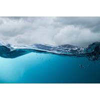
A New Approach to Studying the Air-Sea Flux
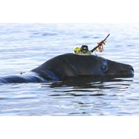
is something USVs are good at, but currently there are large gaps in USV monitoring including in the Pacific Ocean and high latitudes. Additionally, USVs have not yet been active in the Indian Ocean and South Atlantic.Even where USV manufacturers, universities and research institutions have pioneered ground-breaking USV capabilities, the data has been siloed within individual projects, say the researchers.They call for a global network approach that could transform the patchwork of independent USV projects into an established and trusted capability.Already a “USV Network for GOOS” has been
International Seabed Authority Responds to Trump Plan
stakeholders have actively participated and where technical expertise is an essential element.“Though my tenure thus far has been 4 months, I have led the 30th Council and have seen first-hand the goodwill, commitment and ambition that countries are demonstrating in their attempts to find common ground towards advancing the regulatory framework by the end of 2025. I therefore reject any allegation that the Authority is in any way biased towards environmental groups, causing delays and a disadvantage to developing countries. This perspective is naive and disrespects the hard work of Member States
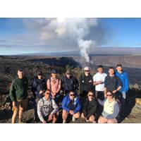
MMA Students Complete Real-World Training in Hawaii
learning courses constitute a key component of MMA’s commitment to providing practical, real-world education, combining classroom instruction with field-based activities.Dr. Kevin Hefferan, who created and led the MSSEP field-based Geological Oceanography course, stated, “We hit the ground running traveling to an active Kilauea eruption before daybreak 3 January upon arrival. We observed lava fountain eruptive cycles 3 and 4 at Kilauea Caldera. As of April 10, Kilauea has erupted 17 times, and this breathtaking lava fountain cycle continues. “We investigate the cyclicity
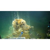
Study of Subsea Volcanoes Aims to Improve Event Forecasting
chambers and how these systems respond during volcanic events, they aim to improve understanding of how fluid circulation can influence the strength and hazard of volcanic eruptions.The Minoan eruption of Santorini, and the 1650 eruption of nearby offshore Kolumbo volcano (Greece) were so large that the ground above collapsed into the space left by the emptying magma chamber, leaving a large hole in the ground, known as a caldera. Such large eruptions can have devastating consequences, as demonstrated recently by the 2022 Hunga Volcano eruption, the most explosive eruption this century, which generated
Grander Canyons
seafloor processes over long distances and in high resolution.In the latest issue of Marine Technology Reporter magazine, Celia Konowe talks to Dr Meg Baker of Durham University about another technology development for understanding the turbidity currents in canyons. These seismographs detect and record ground motion, and they have been used to record the longest runout sediment flows ever measured in action, travelling more than a thousand kilometers along the Congo Canyon.Still, more established technology is also playing a role in understanding the geology of canyons. In 2023, new ocean depths and seascapes
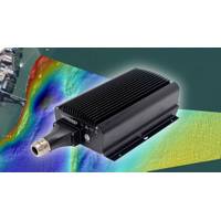
WASSP Equips Multibeam Sonars with Norwegian Subsea’s MRUs
the accuracy of our mapping and survey capabilities. With the ability to deliver RTK equivalent depth accuracy without the need for an RTK connection, this package offers our customers a cost-effective, high-performance solution. It’s a major boost for applications such as seabed mapping, fishing ground exploration, and underwater object detection, particularly in the offshore market,” said Nick Fogarty, Senior Product Manager, WASSP.“WASSP will help bring our innovative motion compensation technology to a wider audience. By combining WASSP’s advanced multibeam sonar with our maintenanc
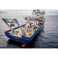
Research Vessels: A Conversation with Bruce Applegate of UNOLS
. “The great thing about our ships is that everyone involved in their operations and management shares a singular focus—supporting the best possible oceanographic research,” Applegate explained. “From physical oceanography to geophysics and marine ecology, our fleet enables groundbreaking science.”Technological innovation significantly enhances oceanographic research capabilities. UNOLS is implementing new technologies to improve operational efficiency and broaden research possibilities. Woods Hole Oceanographic Institution is developing two smaller containerized remotely
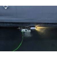
Greensea IQ opens new service center in Miami
;As the cruise industry continues to prioritize operational efficiency and sustainability, EverClean is becoming an essential service for maintaining optimal hull performance,” said John Dunn, Chief Operating Officer of Greensea IQ. “Expanding into Miami allows us to provide direct, on-the-ground support to our growing customer base while also establishing a key foothold for further expansion into the Caribbean.”With more than 250 service deployments in 2024, EverClean is the only proven commercially available proactive in-water hull cleaning service, ensuring vessels maintain peak
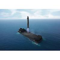
Rocket Lab to Convert Barge for Rocket Landings at Sea
installed on the deck.Expected to enter service in 2026, the 400 ft (122 m) modified barge for Neutron rockets landing will support greater space access for national security missions, civil space exploration, and commercial satellite constellation deployments.Modifications will also include autonomous ground support equipment to capture and secure the landed Neutron, as well as blast shielding to protect equipment during Neutron landings.Oceanus barge (Credit: Rocket Lab)“We’re working hard to bring Neutron online with one of the fastest development schedules in history for a new rocket,


