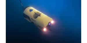
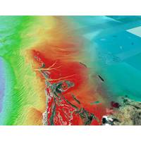
Study of Newly Exposed Sea Floor Reveals Flourishing Ecosystems
the physical and chemical properties of the region. Preliminary data suggest high biological productivity and a strong meltwater flow from the George IV ice shelf.The expedition was part of Challenger 150, a global cooperative focused on deep-sea biological research and endorsed by the Intergovernmental Oceanographic Commission of UNESCO (IOC/UNESCO) as an Ocean Decade Action
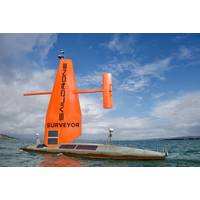
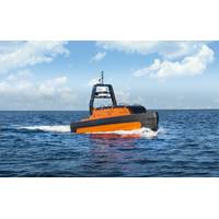
Saildrone, Seabed 2030 in Ocean Mapping Partnership
and GEBCO (The General Bathymetric Chart of the Oceans) to inspire the complete mapping of the world's oceans by 2030 and to compile all bathymetric data into the freely available GEBCO Ocean Map. GEBCO is a joint program of the International Hydrographic Organization (IHO) and the Intergovernmental Oceanographic Commission (IOC) and is the only organization with a mandate to map the entire ocean floor.“We can only realize our goal of a complete map of the ocean floor if we mobilize the international community and work together. We are therefore delighted to partner with Saildrone and leverage
New Working Group Aims to Unlock Private Sector Ocean Data
frameworks and mechanisms that make privately owned ocean science data publicly available for the benefit of humanity.Organized in support of the United Nations Decade of Ocean Science for Sustainable Development, the Ocean Decade Corporate Data Group—co-chaired by Fugro and the Intergovernmental Oceanographic Commission of the United Nations Educational, Scientific and Cultural Organization (IOC/UNESCO)—was officially launched last week during an online kick-off meeting.Five private-sector companies representing a diverse range of industries have joined the group as founding members. They
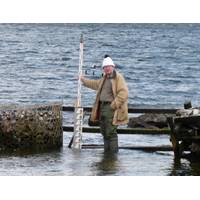
Obituary: Dr. David Thomas Pugh (1943-2022)
(together with Klaus Wyrtki at Hawaii) realized that, if the PSMSL data bank was to develop as one would like, then considerable further efforts in monitoring had to be made at intergovernmental level. This led to his proposal for the Global Sea Level Observing System (GLOSS) of the Intergovernmental Oceanographic Commission (IOC), a UN body with well over 100 member states, in which countries were required to make formal commitments for monitoring sea levels and for delivering data to the PSMSL.In 1984, David’s career changed direction into scientific management after he became Head of Oceanography
Seabed 2030 Enters Partnership with Terradepth
The Nippon Foundation in Japan and the General Bathymetric Chart of the Oceans (GEBCO) with the mission of inspiring 100% mapping of the ocean floor and making it freely available to all by 2030. GEBCO is a joint program of the International Hydrographic Organization (IHO) and the Intergovernmental Oceanographic Commission of UNESCO (IOC-UNESCO). Seabed 2030 comprises five Data Centers – four Regional Centers and one Global Center – which are responsible for coordinating and assembling mapping data.In addition to producing and delivering global GEBCO products, the Seabed 2030 Global Center
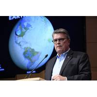
NOAA Research Director McLean to Retire
U.S. deep ocean waters by 2030 and recently passed a significant milestone in October 2021 of two million square kilometers mapped, which is equivalent in size to a quarter of the contiguous United States," NOAA said.McLean has served for 11 years as the U.S. representative to the Intergovernmental Oceanographic Commission of UNESCO where he has helped to lead the new UN Decade of Ocean Science, and as the U.S. representative for the U.S-European Union-Canada Galway Statement on Atlantic Ocean Cooperation. He has been awarded the Department of Commerce Silver and Bronze Medals, and the Support of
The Nippon Foundation-GEBCO Seabed 2030 Project Partner with TCarta
project between The Nippon Foundation and GEBCO to inspire the complete mapping of the world's ocean by 2030, and to compile all bathymetric data into the freely available GEBCO Ocean Map. GEBCO is a joint project of the International Hydrographic Organization (IHO) and the Intergovernmental Oceanographic Commission (IOC) and is the only organisation with a mandate to map the entire ocean floor. Seabed 2030 is formally endorsed as a Decade Action of the UN Decade of Ocean Science for Sustainable Development.TCarta has been a global innovator in Satellite Derived Bathymetry (SDB), marine remote
Kongsberg Maritime Signs on to help fast-track Seabed 2030 Project
project between The Nippon Foundation and GEBCO to inspire the complete mapping of the world's ocean by 2030, and to compile all bathymetric data into the freely available GEBCO Ocean Map. GEBCO is a joint project of the International Hydrographic Organization (IHO) and the Intergovernmental Oceanographic Commission (IOC), and is the only organisation with a mandate to map the entire ocean floor.All data collected and shared with the Seabed 2030 Project is included in the GEBCO global grid, which is free and publicly available.Photo courtesy Nippon Foundation-GEBC
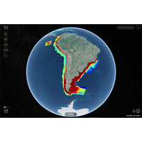
Scientist Pool Data to Create the $3B Ocean Map
to determine their continental shelves and exclusive economic zones - legitimate territorial claims off their coasts.It also spurred a rush to map and claim land, said Larter."That's the biggest land grab in recent history," he said.For Julian Barbiere of UNESCO's Intergovernmental Oceanographic Commission, it would be a "paradox" if, after collaboration at a scientific and technical level to share data, countries used that knowledge against each other in geopolitical spats."There are already tensions in some parts of the world, and one of the reasons for that is access