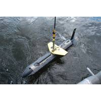
Klein Marine Systems Selects Exail Navigation Technology For Sonar
Nano OEM AHRS offers a heading accuracy of 0.5° secant latitude, and pitch and roll accuracy of 0.1°, ensuring stable and precise attitude and heading data. These capabilities are essential for optimizing sonar image quality, improving positioning accuracy, and reducing the need for extensive post-processing. The system’s compact design and low power consumption allow for seamless integration into subsea platforms, making it ideal for extended underwater missions where precise attitude data is critical.The Exail Octans Nano OEM AHRS. Credit: ExhailThe Klein 5900 SSS is known for its high-resol
Sonardyne, Echoview Software Collaborate to Enhance ADCPs
enhances offshore environmental monitoring by enabling simultaneous measurement of water velocities and biological activity, with the echosounder working alongside the ADCP's existing functionality to record detailed insights into marine environments. This data is then brought to life through post processing in Echoview.The echosounder feature collects detailed backscatter measurements from objects in the water column, including gas bubbles, biological organisms, fish shoals and physical processes such as internal waves and sediment plumes. When combined with the ADCP's water velocity measurements
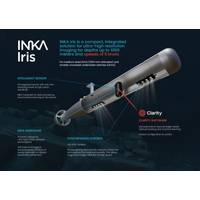
Cathx Ocean Unveils New INKA Camera
Offshore surveyors and operators have long faced the challenge of data bottlenecks, where vast amounts of raw subsea data require time-consuming post-mission processing, leading to delays and increased operational costs. Cathx Ocean is set to solve this problem with the launch of INKA Iris at UDT 2025.INKA is Cathx Ocean’s onboard hardware processing platform, designed to bring real-time AI-driven decision-making to subsea vehicles. Iris is the first camera built on the INKA platform, delivering imaging and onboard data processing in a compact, power-efficient package. Built on customer feedback
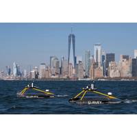
XOCEAN Nets $118M Investment to Expand Offshore Operations
growing demand for high-quality data solutions across the blue economy.Founded in Ireland in 2017, XOCEAN has been operating in offshore geophysical data delivery space with its fleet of Uncrewed Surface Vessels (USVs).These USVs combine mission endurance, advanced sensors, real-time communications, and post-processing expertise to offer clients a flexible, cost-effective solution for the delivery of their offshore geophysical data needs."Our mission is to deliver data that drives the sustainable development of our oceans in a safe, cost-effective, and ultra-low-impact way. Today, we are providing
Teledyne Marine Adds iOne Resources as Philippines Distributor
, including RESON, PDS, ODOM Hydrographic, Bowtech, Gavia, Oceanscience, RD Instruments, TSS and BlueView. The company will provide sales and support for the following Teledyne Marine product lines:High-resolution multibeam sonar systems for hydrographic and oceanographic surveys.Data acquisition and post-processing software for a wide range of marine applications.Single-beam echo sounders designed for bathymetric data collection.Motion and inertial sensors for marine navigation, subsea positioning, and dynamic monitoring.Compact, high-resolution sonar solutions for imaging and measurement in underwater
Kongsberg Discovery Launches Seapath 385 Navigation System
the system’s inertial sensor and updated navigation algorithms, dead reckoning performance is second to none, says Kongsberg Discovery. In addition, another layer of robustness is added by the innovative utilisation of GNSS antennas for both positioning and heading determination. A new post processing format contains all necessary data and system configuration in a single file, with the possibility of achieving centimetre position accuracy through downloaded satellite orbit and clock data, or data logged from base stations.The modular system, with a processing unit running all critical

AI & Seabed Mapping Project Recognized
and consistent results comparable to that of an experienced surveyor, without needing any human intervention and operating at a fraction of the time. The AI module was integrated into the company’s existing software and is capable of processing survey data in real-time, saving days or weeks of post-processing by trained human users.Dr. Danny Websdale, the Knowledge Transfer Partnership Senior Research Associate at University of East Anglia for the duration of the AI development project and now an AI/ML Research Scientist at GeoAcoustics Ltd said: “Designing an AI system that can process
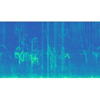
Saildrone Unveils New Acoustic Capabilities to Protect Marine Mammals
in a non-invasive and cost-effective manner and, combined with the mobility and endurance of our uncrewed platforms, provides unprecedented monitoring capability, facilitating research, conservation, and commercial enterprise.”Now, RPS’s acoustic scientists have the exciting task of post-processing the data collected by Saildrone, identifying the types of calls detected and the species producing those calls. One of the tools that the analysts will use is RPS’s machine learning tool, Neptune, a predictive algorithm for accurate, reliable detection of marine mammal vocalizations
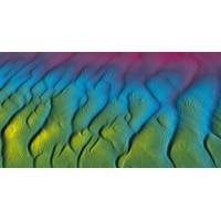
Tech File: AI-powered Bathymetric Data Processing
data, without any user intervention in the cleaning process, enabling better operational agility and decision support, while cutting the time to final data in post-processing.The processing happens in real-time, so users only need to oversee data quality and coverage during acquisition, while at the post processing stage, the focus can be purely on georeferencing the bathymetric data using deterministic calculations. The final, noise free and high-resolution bathy products will be fully reproducible with minimal human intervention.Image courtesy GeoAcoustic