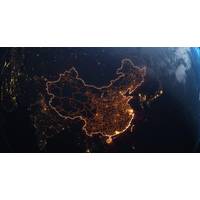
China Mapping Ocean Floor Ready for Submarine Warfare
ranges and sits astride the approach to the strategically essential Malacca Strait, through which much of China's oil supply passes.Ocean University and the Institute of Oceanology, which is part of the Chinese Academy of Sciences, have said the wider network of sensors now provides China with real-time data about water conditions and subsea movements.Some naval-warfare experts expressed caution about that claim, given technical challenges with real-time communication of data from underwater. But even delayed data is valuable, Parker said, as it could help China detect U.S. submarine operations
IQUA Robotics Successful Proves Use of AUV for Autonomous Ship Hull Inspection
of an autonomous vehicle like the Sparus II AUV allows for systematic hull scanning without direct intervention from an operator in piloting.Throughout the project, several key technical capabilities have been validated:Adaptive tracking: The vehicle uses a multibeam sonar to detect the hull profile in real-time, adjusting its navigation to maintain a constant distance.Systematic navigation: The system executes adaptive "lawnmower" type trajectories that ensure complete and uniform coverage of the inspected area to collect hull images.Operational safety: Protocols have been implemented that
China Maps Ocean Floor as It Builds Submarine Warfare Capability
ranges and sits astride the approach to the strategically essential Malacca Strait, through which much of China's oil supply passes.Ocean University and the Institute of Oceanology, which is part of the Chinese Academy of Sciences, have said the wider network of sensors now provides China with real-time data about water conditions and subsea movements.Some naval-warfare experts expressed caution about that claim, given technical challenges with real-time communication of data from underwater. But even delayed data is valuable, Parker said, as it could help China detect U.S. submarine operations

Bridging the Data Divide: How AI Will Rewire Maritime, Port Ops
traditional EDI messages, and converts them into real-time, usable information streams that can be shared across the ecosystem.“Think of it like this,” he said. “You have the letter, but it’s written in a language your partner can’t read. What we do is translate it, in real time, into whatever format they need, and then translate it back when they respond.”The practical impact is straightforward. Trucking companies know exactly when cargo is ready. Cargo owners gain visibility into container status. Regulators receive accurate, timely data. Ports, in turn, can move
Advanced Navigation Raises $110M Series C to Support Increased PNT Technology Demand
a layered, multi-sensor architecture designed to operate with total autonomy, even when GPS signals are degraded or lost.At the core of this architecture is AdNav Intelligence (AI), the company’s software fusion engine. It continuously combines and cross checks data from multiple sensors in real time, while adapting to each mission’s requirements. This ensures autonomous vehicles, aircraft, ships and robots understand exactly where they are and keep moving with confidence, no matter the environment.Global ExpansionWith more than 100,000 systems deployed across global nations, Advanced
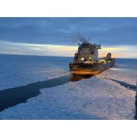
Breaking the Ice: How a Space-Based Initiative is Solving a Maritime Challenge
imagery.The results were game-changing. The winning team, IceScope GL from the University of Michigan, turned raw satellite streams into a user-friendly interface, a digital "spatial field" of ice formation. Their solution provides icebreakers with a four-day advance notice. This tool displays real-time ice formation and, crucially, generates cutter deployment recommendations based on predicted pressure ridges and thickness. For their efforts, the team took home the $15,000 top prize, followed by the second and third place teams who secured $10,000 and $5,000 for similarly impressive predictive
FreeStar Delivers Rapid Multi-Technology Cable Survey for TenneT
approach, the Seekable TN 1 accurately predicts cable position even when the sensors are offset from the cable’s actual alignment.Designed for offshore and nearshore environments, the TN 1 integrates high resolution magnetic field measurements with advanced data modelling to deliver precise, real time tracking results. This capability enables faster and safer cable route surveys, reducing vessel time and operational costs.By combining these techniques, the project stakeholders were able to collect complementary datasets while operating from a single offshore platform.A defining feature of the

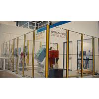
Breakthrough Technology Unveiled at Oceanology International
attending this year.”Deep tech company WSense launched WCloud, its live, cloud‑based platform that powers next‑generation wireless underwater monitoring and communication systems. The wireless underwater network is capable of integrating and visualizing dozens of sensors at once, delivering real time underwater visualization, advanced analytics for smarter decisions and generative AI powered insights and KPIs.On the booth, visitors explored actual data streams, immersive dashboards, and the tools that transform underwater data into actionable intelligence for environmental, industrial, and
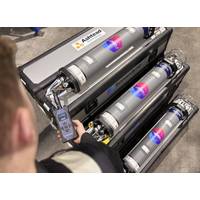
Ashtead Technology Places New Order for Sonardyne’s Fusion 2 Platform
Ashtead Technology’s rental fleet of Sonardyne Compatt 6+ to well over 1,000 units. The units integrate Long BaseLine (LBL) and SPRINT INS into a single, streamlined platform, Fusion 2, supported by Sonardyne's 6+ hardware.Fusion 2’s advanced capabilities include full LBL support, real-time SLAM calibration for sparse arrays and wireless structure deflection monitoring.These features significantly reduce transponder count, vessel time and operational costs while ensuring centimetric accuracy in subsea positioning.As well as Compatt 6+ and ROVNav 6+ Ashtead Technology’s expanded