NOAA Releases Images of Seabed Nodules From Hydrographic Survey Near American Samoa


-
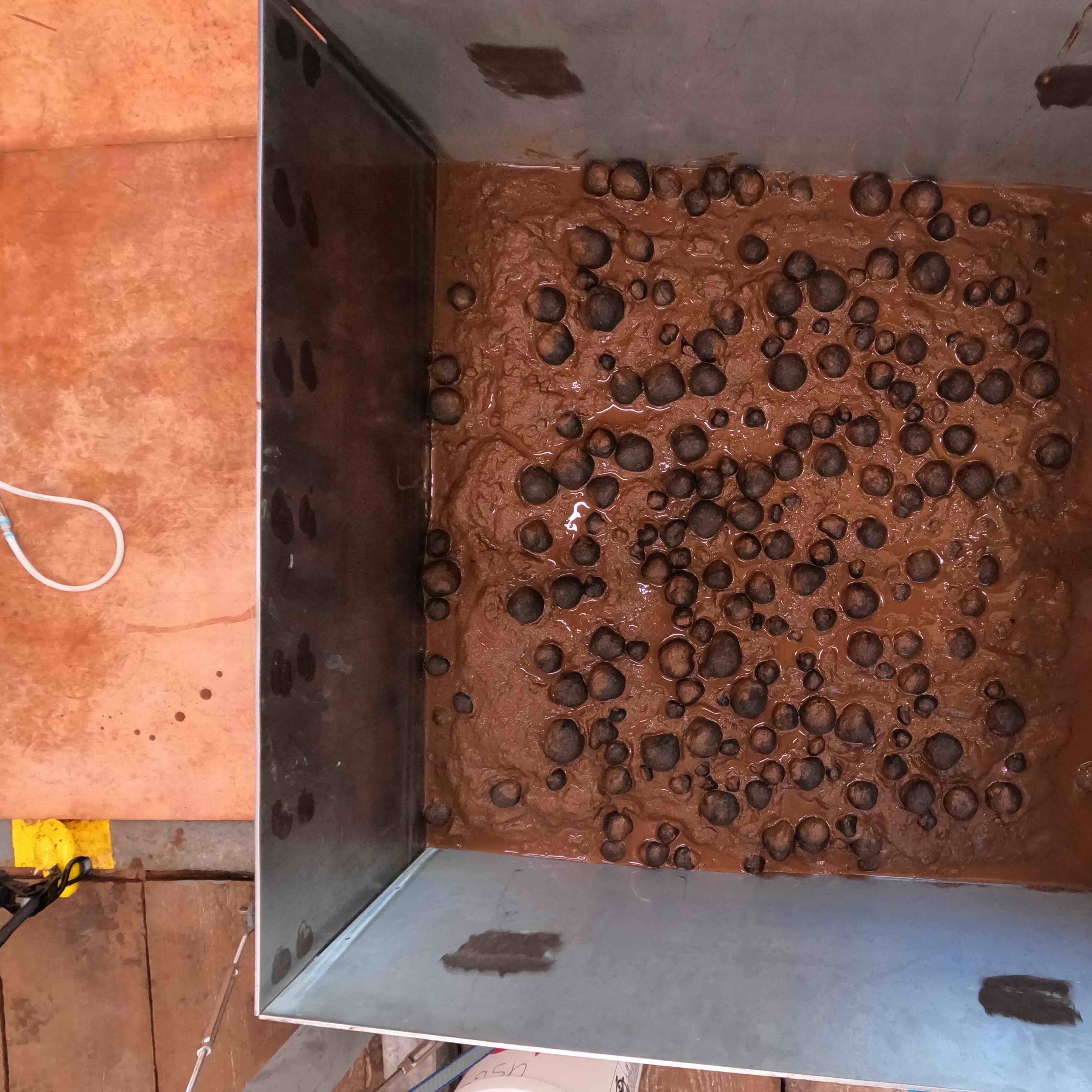
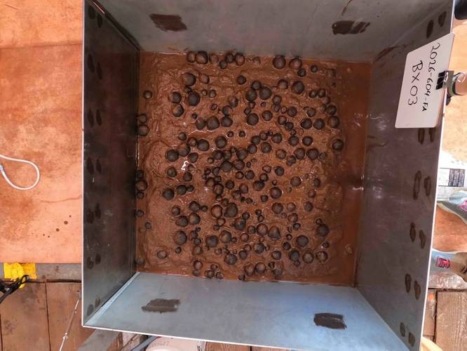 Image of geological samples from the seafloor that were collected via box core on April 14, 2026, in U.S. waters off American Samoa. Credit: USGS
-
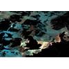
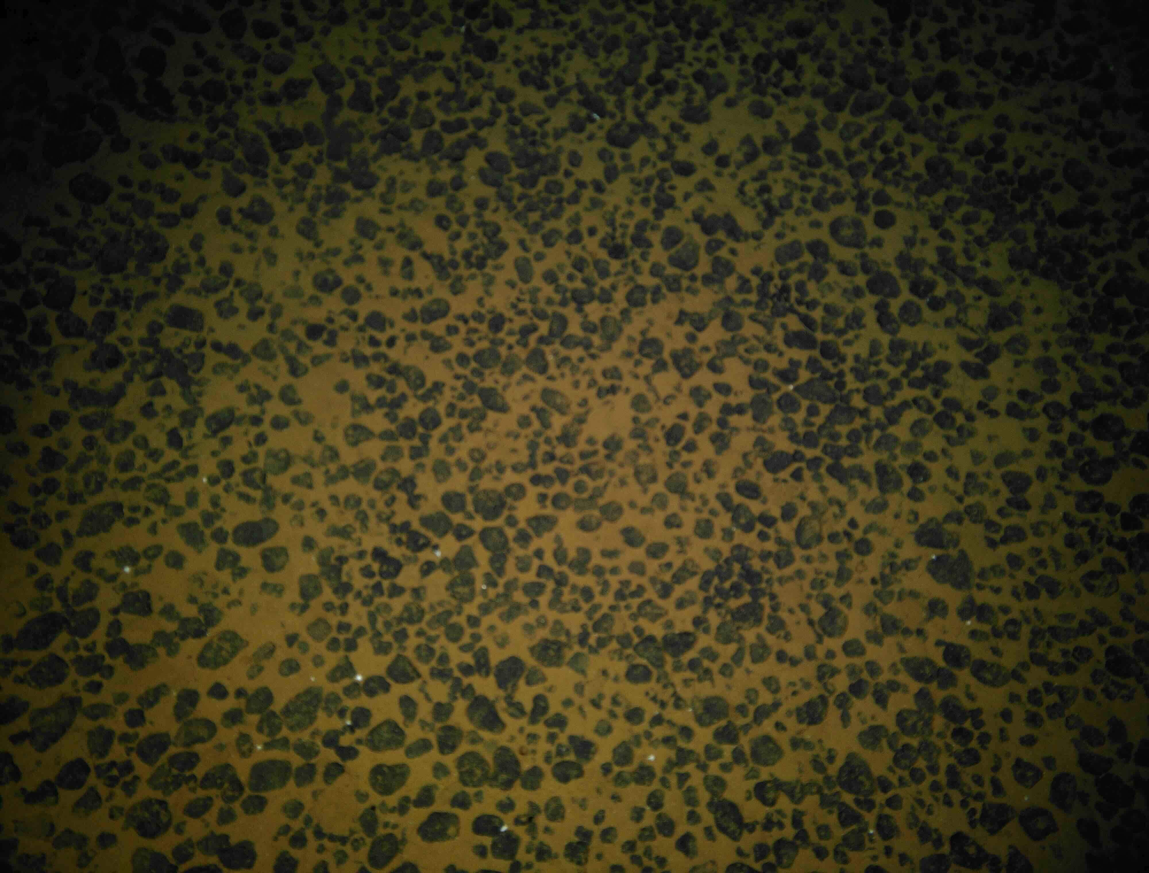
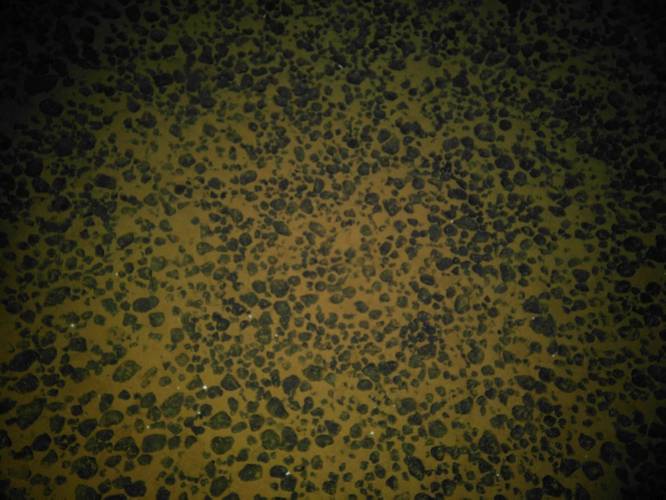 Presumed polymetallic nodules on the seafloor off American Samoa at a depth of 5,498 meters (3.42 miles) prior to the collection of a box core. Credit: NOAA
NOAA released the first images of geologic seafloor samples from a hydrographic survey project to map and characterize more than 30,000 square nautical miles of federal waters in the U.S. exclusive economic zone (EEZ) beyond the territorial waters of American Samoa. The box core samples will allow for further analysis to understand the composition of deep sea resources and the environments in which they are found.
“NOAA’s mapping missions serve as a reminder that ocean exploration is a vital piece of our nation’s economic development,” said NOAA Administrator Neil Jacobs, Ph.D. “These images highlight the outstanding work of our NOAA team and partners to characterize the seafloor, and the data gathered during this historic project will enable science-based decision-making to support responsible development.”
The new images were collected as part of a Department of Commerce initiative to implement the U.S. Offshore Critical Minerals Mapping Plan as defined by Executive Order 14285: Unleashing America's Offshore Critical Minerals and Resources. In developing the mapping plan, NOAA, in consultation with the Department of Interior’s Bureau of Ocean Energy Management (BOEM) identified the federal waters near American Samoa as a priority area of the seabed for mapping and analyzing nodules that may contain critical minerals.
As the mission remains underway, images of the seafloor and box core samples will be posted online on a rolling basis, serving as an initial indication of mineral resource potential and the deep-ocean marine environment in the federal waters off American Samoa. Scientists from the U.S. Geological Survey (USGS) will conduct analyses of the seafloor composition, which will enhance scientific understanding of the deep seabed in the region and inform future exploration and activities related to deep seabed minerals. USGS plans to release the initial analyses from this work early this summer.
NOAA’s Office of Coast Survey is leading the project contract, with NOAA Ocean Exploration, BOEM, and USGS providing additional scientific expertise and guidance.