Marine Technology News Search
Search term • "advanced navigation"
Create an email alert for "advanced navigation"
GPS-aided Inertial Navigation System on a Chip
VectorNav Technologies launch the VN-200, high-accuracy GPS-Aided Inertial Navigation System (GPS/INS) on a surface-mount chip the size of a postage stamp. Combining an advanced GPS module with the latest in MEMS inertial and pressure sensor technology, the patent-pending VN-200 provides a coupled position, velocity and attitude solution that is robust to a wide range of static and dynamic operating conditions.
C-Nav Launches Tide Measurement Package
C-Nav, a supplier of international GNSS Precise Point Positioning services, announced the launch of its latest GNSS Real-time tide measurement package, C-Tides. The C-Tides suite combines the exceptional vertical accuracy of C-Nav's GNSS Precise Point Positioning service with the latest advanced ocean and coastal tides models. C-Tides Online features real-time filters and vessel dynamics, choice of world-wide Mean Sea Surface or regional reference frame models…
Nautilus Announces Closing of Rights Offering
Nautilus Minerals Inc. announced that it has received gross proceeds of C$40 million before expenses as a result of the successful closing of its rights offering through the issuance of 200,000,000 common shares at a subscription price of C$0.20 per common share. Under the rights offering, 125,485,507 common shares were issued under the initial subscription with 25,136,966 common shares issued under the additional subscription.
Kongsberg Wins Drilling Rig Contracts in China and Korea
CIMC Yantai Raffles in China and STX Offshore & Shipbuilding in Korea have selected extensive Dynamic Positioning (DP), Automation, new generation Safety System, Integrated Navigation, Hydroacoustic positioning and latest riser management solutions from Kongsberg. The contracts are for two new Frigstad D90 Design drilling rigs and one Bassoe Technology BT-UDS Design drillship. The total value of the contracts is in excess of MNOK 150. The contracts have options for a total of 8 additional units.
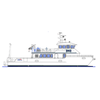
University of North Carolina Wilmington Orders Research Vessel from All American Marine
Bellingham, Wash. shipbuilder All American Marine (AAM) announced it has been awarded a contract to build a 73-foot research vessel for the University of North Carolina Wilmington (UNCW). The vessel will operate as a multipurpose research platform capable of conducting a wide range of scientific missions, including oceanographic surveys, biological studies and educational outreach programs along the Mid-Atlantic, U.S.

Richard W. Spinrad, Ph.D.: MTR's 2021 #1 Ocean Influencer
Richard (Rick) W. Spinrad, Ph.D., was sworn in on June 22, 2021 as the Under Secretary of Commerce for Oceans and Atmosphere and the 11th NOAA Administrator. Dr. Spinrad has a long and distinguished career, and he certainly needs no introduction to the MTR audience, or explanation for our rationale in making him our Number One Ocean Influencer of 2021.Rick to start, please give a “By the Numbers” overview of NOAA today.I have to start with the workforce…

Support for Jones Act, Concern about China Voiced at Maritime Infrastructure Hearing
US Coast Guard and Maritime Transportation Subcommittee Chairman Mike Ezell (R-MS) addressed a hearing titled “America Builds: Maritime Infrastructure” on Wednesday saying: “It is clearly critical that we must build a safer and more efficient system.”The new chairman, for the 119th Congress, said the Jones Act is quite literally the bedrock and foundation of the nation’s shipbuilding industrial base…

... And the Winner is ...
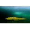
The 2024 Teledyne Marine Photo Contest Winners Teledyne Marine announced the winners of its 2024 Teledyne Marine Photo Contest, a contest which attracted entries from around the globe.Winner Voters Choice Award-Grand PrizeBest image among the Top 10 most popular photos, this photograph is mind-blowing in its composition: Teledyne Gavia AUV and the Teledyne RDI Pathfinder DVL for precise underwater navigation and data collection. Teledyne WinADCP software was also used.

FET Inks Deal to Expand Shallow Water Ops
Forum Energy Technologies' (FET) Subsea Product Line has signed a contract for the sale of an electric Sub Atlantic Super Mohawk II remotely operated vehicle (ROV) and Dynacon Launch and Recovery (LARS) system to a North American subsea organization. The ROV will be used for shallow water operations in the Northeastern United States, marking the company’s first sale for river bed assessments alongside…
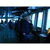
Ice Navigation: Every Voyage is Different
It’s late in the season so Captain Duke Snider, sailing on a resupply voyage from New Zealand to Antarctica, is expecting virtually no sea, just glacial ice.Snider has been an ice navigator for decades, and he has seen the ocean change, not just here in the polar south, but in Arctic waters as well.“Variability is much greater than in the past when we could expect an ice breakup to occur within a calendar week, year after year, whether it was the Arctic or the Antarctic,” he says.

FarSounder Turns 20
This year marks two decades that FarSounder has been dedicated to developing its unique 3D Forward Looking Sonar technology (3D FLS). Back in 2001, the company's founders saw a need for a solution to answer the question of what is in front of my vessel underwater right now. This real world issue has since been mitigated with the innovative Argos navigation sonar systems.“These 20 years have been a fascinating journey.
Irish Naval Service Acquires Navigator Diver Held Sonar
The Irish Naval Service has acquired a Navigator Diver Held Sonar and Navigation System manufactured by Shark Marine Technologies Inc. of Ontario, Canada. The Irish Naval Service is the State’s Principal Seagoing Agency. The Naval Service exercises and upholds the States sovereignty and obligations over Ireland’s maritime jurisdiction which is an area 12 times larger than the island of Ireland. The Naval Service Diving Section (NSDS) is the primary State diving team…
OSI to Deliver TDNS to the Royal Swedish Navy
OSI Maritime Systems (OSI) announced the award of a contract for the Company's Tactical Dived Navigation System (TDNS). The Systems will be delivered to ThyssenKrupp Marine Systems AB as part of a Royal Swedish Navy submarine upgrade program, and includes OSI's subsurface WECDIS software. Navies worldwide have made ECPINS their choice for WECDIS (Warship ECDIS) because of the advanced features and OSI's extensive experience in warship navigation, OSI said.

ROBOTICS: Meet Your New Offshore Robotic Co-workers; Charles, Eddie, ANYmal & Spot
Within the last 12 months, a series of significant steps have been made in the world of offshore robotics; a number of legged and tracked robots made their first steps onto and around offshore facilities in Malaysia, the Netherlands, Norway and the US. For operators, it’s a big leap to have these things on facilities. For technology developers, it’s a big step towards future potential adoption offshore.In August last year (2020)…
NKT Secures Two High-Voltage Cable Projects for TenneT’s 2GW Program
The Dutch-German transmission system operator (TSO) TenneT has selected Danish subsea cable and services firm NKT to provide onshore and offshore high-voltage cable systems for two projects in Germany as part of its 2 GW grid infrastructure program.Under the existing multi-year framework agreement with TenneT. NKT will provide 525 kV XLPE high-voltage direct current (HVDC) onshore and offshore power…

DeepSea Launches SmartSight MV100 Machine Vision Camera
DeepSea Power & Light has launched the first in its line of cameras for machine vision applications: the SmartSight™ MV100.The SmartSight MV100 leverages machine learning and AI to bring object recognition, navigation, inspection technology, and other value-add autonomous solutions to the subsea market.The SmartSight MV100 camera includes a Gigabit Ethernet interface for easy integration with existing platforms and a low power consumption, making it well suited for autonomous vehicles.

Webinar: Advancing Hydrographic Surveying with Centimeter Accuracy in Real-Time
Join us for an exclusive webinar where you’ll learn more about Applanix POS MV and CenterPoint RTX Marine correction service, powerful combination for elevating your hydrographic and bathymetric surveying. In the fast-paced world of marine surveying, real-time data is becoming increasingly important for making informed decisions on the water.We will explore how CenterPoint RTX Marine delivers satellite-delivered GNSS data…
SeaMe Project to Leverage AUVs, AI to 'Stand Watch' in Offshore Wind Farms
In the Sustainable Ecosystem Approach in Monitoring the Marine Environment (SeaMe) project, RWE is collaborating with research partners to develop technologies for comprehensive ecosystem monitoring. The German Research Center for Artificial Intelligence (DFKI) is contributing by equipping an autonomous underwater vehicle with oceanographic sensors and artificial intelligence technologies to enable safe navigation and precise data collection.With the SeaMe project…

Ocean Discovery League Aims to Double Deep Seafloor Observations
Ocean Discovery League (ODL) has launched the Global Deep Sea Exploration Goals, an international effort to visually explore 10,000 strategically selected locations across the deep seafloor.When completed, this initiative will nearly double the number of unique seafloor locations ever visually observed and produce the first globally representative visual dataset of the deep ocean floor.The methodology…

NOAA Accelerates Permitting Timeline for Deep Seabed Mining Applications
NOAA announced revisions to the regulations for exploration licenses and commercial recovery permit applications under the Deep Seabed Hard Mineral Resources Act (DSHMRA), an anticipated milestone in NOAA’s effort to streamline the deep seabed mining permitting framework. The revisions establish a consolidated DSHMRA exploration license and commercial recovery permit application process, which is effective on the date of publication.


