Teledyne Optech Environmental Monitoring In Focus

Photo: Teledyne Optech
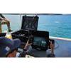
Coastal Zone Mapping and Imaging Lidar System (CZMIL) has been a critical rapid environmental assessment tool for both natural and man-made disasters
Teledyne Optech’s Coastal Zone Mapping and Imaging Lidar (CZMIL) system is a critical rapid environmental assessment tool for monitoring natural and manmade disasters. From detecting sewage pipe leaks, mapping oil slicks and measuring coastline changes after hurricanes, to counting underwater debris in the Great Pacific Garbage Patch, CZMIL identifies and monitors oceanic environmental changes, especially in emergency scenarios.
At the Oceans '17 MTS/IEEE conference in Aberdeen, Scotland, Senior Scientist Dr. Viktor Feygels will present “CZMIL as a Rapid Environmental Disaster Response Tool”. Using case studies from CZMIL and its predecessor systems, Dr. Feygels will describe four distinct applications of Teledyne Optech lidar bathymeters.
In addition, Research Scientist Hieu Duong and Marine Business Manager Bob Marthouse will present “Small-Object Detection using Coastal Zone Mapping and Imaging Lidar (CZMIL)” at the Teledyne CARIS International User Group Conference in Ottawa, Canada.
“CZMIL has proved to be ideally suited for rapid environmental assessment and small-object detection,” Marthouse said. “Both the upcoming MTS/IEEE Oceans ‘17 conference and the recent United Nations Ocean Conference during the week of June 5 underline the urgent requirement to more critically monitor our oceans and coastlines. At Teledyne Optech, we were pleased to be part of this ongoing effort.”