Voyis, EIVA Introduce Geo-Located Camera-Based Mapping
© Voyis
Voyis and EIVA, both part of the Covelya Group, announced an update to Voyis VSLAM Powered by EIVA NaviSuite. This technical advancement brings absolute geo-located mapping to real-time camera-based 3D reconstruction for subsea inspection and metrology. This new capability enables VSLAM-generated point clouds to be projected directly into global coordinates, from the moment an inspection mission begins.
This marks the first time that real-time visual mapping is natively aligned to global geodetic frames, bridging the gap between camera-based navigation and established industry survey standards.
Extending EIVA's Geodesy to Camera-Based Mapping
For more than 40 years, EIVA's NaviSuite geodesy computational tools have underpinned professional subsea survey and inspection workflows. The new update extends these same trusted geodetic capabilities directly into Voyis VSLAM Powered by EIVA NaviSuite, enabling visual point clouds to adhere to the same coordinate handling, consistency, and reliability expected in offshore operations.
By embedding NaviSuite's geodetic engine, users can now define geodetic settings, including selecting coordinate systems from the full EPSG Library, before data acquisition begins. This ensures that every 3D point generated by the VSLAM solution is immediately tied to a known global reference frame.
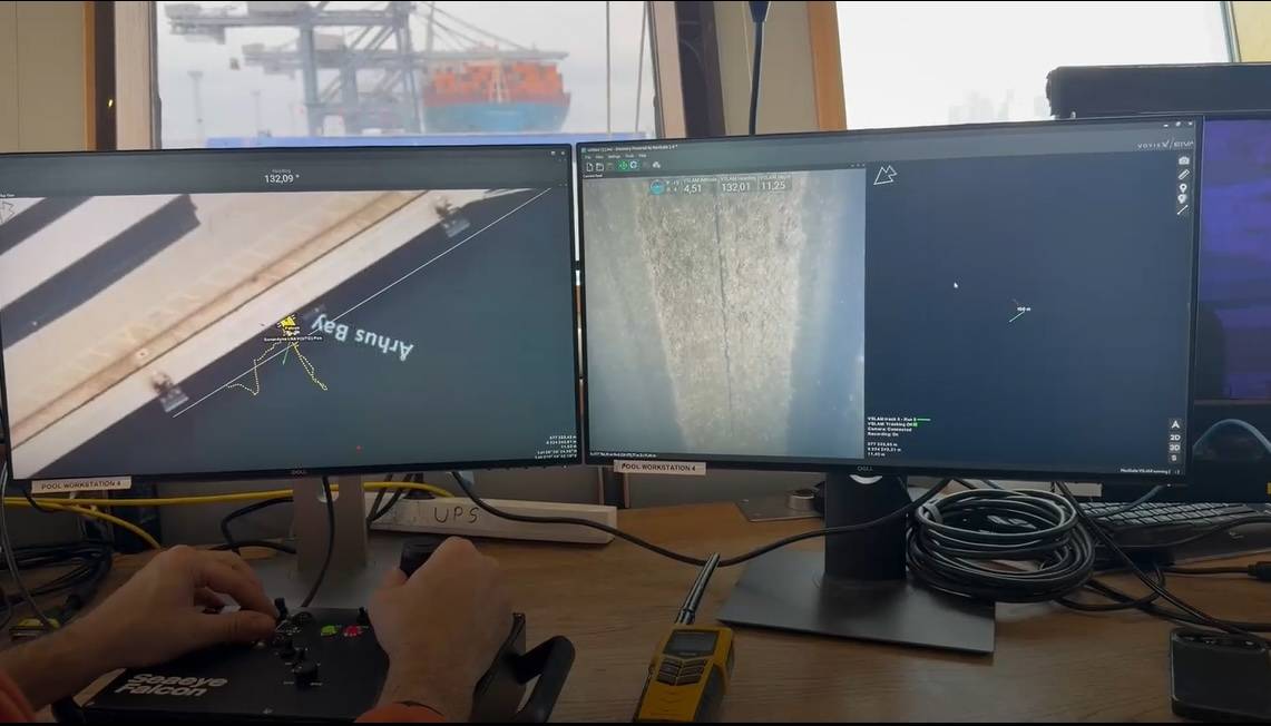
Absolute Geo-Located Mapping from the Start of a Dive
Voyis VSLAM Powered by ElVA NaviSuite reads the initial global position from a connected
INS, such as a Sonardyne SPRINT-Nav, and places the map into the selected geodetic frame at mission start. This global placement is preserved throughout the dive, even after relocalization or loop closure events. While the SLAM engine continues refining local map geometry, its global alignment remains stable.
This advancement transforms how pilots and surveyors interact with real-time camera-based 3D reconstruction:
- Situational awareness improves, with the ability to load background maps, reference charts, or seabed models directly beneath the live VSLAM point cloud.
- A priori models, such as CAD drawings of subsea structures, can be overlaid for immediate comparison and navigation.
- Inspection targets and points of interest can be marked in absolute coordinates and revisited across dives, days, or vessels.
- ROV navigation becomes more intuitive, enabling safer manueuvering, cleaner tether management, and easier return-to-start positioning.
Operational Impact: Consistency, Efficiency, and Repeatability
The updated VSLAM solution elevates visual mapping from a purely relative model to a globally consistent dataset, enabling:
- Cross-dive continuity: Operators can resume inspections exactly where they ended, with the VSLAM map already aligned to the global frame.
- Faster data interpretation: Global positioning simplifies correlation between inspection data, engineering drawings, and historic survey datasets.
- Improved mission efficiency: Aligning to known structures and reference frames reduces redundant coverage and streamlines planning.
- Enhanced safety: Pilots benefit from live context by seeing real-time visual data within the surrounding geospatial environment.
This step reduces the operational burden traditionally associated with reconciling visual reconstructions against external positioning data, making camera-based inspections more robust and survey-ready.
Once collected, point clouds generated by Voyis VSLAM Powered by EIVA NaviSuite can be further managed through NaviModel, where users can re-project datasets into alternative reference frames as project needs evolve, ensuring compatibility with engineering standards and long-term inspection archives.