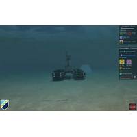
Greensea IQ Launches Bayonet AUGV Training Simulator
scenarios, learning the software, and understanding their role as partners with an autonomous system.All of Bayonet’s autonomous features are fully enabled and available, from mission execution, obstacle avoidance, and target interrogation, to Automatic Target Recognition. Workspace’s data management systems are also fully functional, supporting data recording and playback as well as integration with TAK systems and Greensea’s post mission analysis toolchain. The Bayonet AUGV Simulator is built on Greensea’s new simulation engine for Greensea’s software systems. Training
Scripps Awarded $15 Million for Environmental Surveys
. Newer Deep Argo floats can dive to 6,000 meters (19,685 feet), sampling the full water column.The funding will enable approximately 50 Deep Argo floats to be deployed by Scripps, Woods Hole Oceanographic Institution and NOAA's Pacific Marine Environmental Laboratory, with NOAA providing ongoing data management support.The effort, which builds on past investment from Allen Family Philanthropies, will prioritize regions with little or no current coverage and enable real-time monitoring of the global deep ocean for the first time in history.The deep ocean helps control global climate via its roles regulating
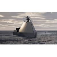
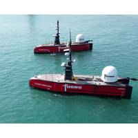
USVs Getting Smarter, Faster and More Flexible
vehicles (UUV) and unmanned aerial vehicles (UAV).Odyssey enables control of either individual assets or swarms, and its mission library delivers high-level autonomy in executing rapid single-agent tasks or complex, multi-agent scenarios in coordination with crewed and unmanned platforms. Secure data management enables instant analytics or detailed post-mission review, while its modular design supports seamless integration of customer or third-party sensors, payloads, algorithms, and interfaces.Also this month, BMT unveiled its Modular Uncrewed Ship concept MODUS. Working to a new design philosophy
Fugro to Deliver Offshore Surveys at Major Energy Fields in Middle East
to support the strategic client’s Front End Engineering Design (FEED) process.The scopes of work include surveys for pipelines, cables, artificial islands, and offshore structures.Fugro’s integrated approach will deliver near real-time insights into ground conditions via its remote data management solutions, enabling the client to make timely, well-informed design decisions and realize significant capital expenditure savings across the development program.“We are proud to support these landmark field developments with our full suite of site characterization and consulting services
Seequent Receives Award at Global Offshore Wind 2025, Hosts Upcoming Webinar
Seequent, a leader in earth-modeling, analysis, data management, and collaboration software, received the Sust2ainable Exhibitor Award from RenewableUK at the Global Offshore Wind 2025 event. At the event, Seequent demonstrated how its 3D ground modeling technology is transforming the offshore wind industry by:Automating data collection from remote subsurface locationsVisualizing insights with intuitive 2D and 3D modelsAccelerating decisions and reduce riskRenewableUK's commitment to sustainability was also highlighted through their 5 Rs principles:Rethink: Use less harmful alternatives to
John Siddorn, CEO, National Oceanography Center
became the Liverpool Tidal Institute. It led development of the methods of tidal prediction used world-wide today. It broadened its research over the years into prediction of storm surges and then sea level science more generally, as well as coastal and continental shelf sea oceanography and marine data management.In 1965 both the NIO and the Liverpool Tidal Institute became part of the then newly-formed Natural Environment Research Council (NERC). Both were brought together to form NERC’s Institute of Oceanographic Sciences (IOS) in the 1970s. Both former parts of IOS came back together in 2010

A New Approach to Studying the Air-Sea Flux
researchers propose a governance framework and a core steering committee comprising three leadership committees to lead the network. Each leadership committee will be made up of stakeholders across what they consider are the three crucial aspects to delivering ocean data using USVs: science, data management and public-private partnerships.To date, the network committee comprises the co-authors of the paper. They meet intermittently to share news and ideas and to work on collaborative funding proposals.A core committee will be formed within the next 12 months.“This paper is a first step in
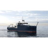
Kongsberg Discovery Technology Sets Sail On One Ocean Expedition Research Voyage
and understand unique ocean environments, including the waters of the legendary Northwest Passage.Onboard systems now include 75 and 300 kHz ADCPs, EK80 Echo Sounders, an advanced hydrophone cluster, and the Seapath GNSS-aided inertial navigation system, while Blue Insight, a cutting-edge ocean data management and analytics platform, will process and share captured data with land-based teams daily. In addition, a wide range of equipment, such as weather stations, water samplers, situational awareness, and motion reference units, has also been integrated.The One Ocean Expedition 2025-2026 is a 12-month
Kongsberg Discovery Launches Digital “Librarian”
massive data streams from a wide range of environmental, meteorological and acoustic sensors.“Survey teams are busy enough without wrestling with incompatible formats and fragmented systems,” comments Audun Berg, EVP of Kongsberg Discovery. “Geomatics takes the hassle out of data management, giving users a single, intuitive platform that lets them focus on the mission – simplifying complexity and optimizing efficiency.“Think of it as the perfect librarian for ocean data: one that makes sure all data is correctly filed, easy to find, and displayed clearly, for all relevant