Kongsberg Discovery Launches Digital “Librarian”
Source: Kongsberg Discovery
Kongsberg Discovery has unveiled Geomatics, a new digital product designed to transform how ocean data is captured, managed and accessed.
Launched at Ocean Business 2025, the solution enables both traditional and uncrewed vessel operators to streamline data operations, unlock operational insights and improve global collaboration between vessels and shore-based teams.
As ocean activity accelerates and initiatives like the UN Decade of Ocean Science target efforts to map the seabed by 2030, the ability to manage vast volumes of complex data – across a myriad of sensors, formats and protocols - is more critical than ever.
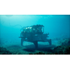
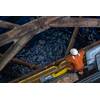
Modern survey vessels, often operating as part of multi-platform fleets with AUVs and USVs, generate massive data streams from a wide range of environmental, meteorological and acoustic sensors.
“Survey teams are busy enough without wrestling with incompatible formats and fragmented systems,” comments Audun Berg, EVP of Kongsberg Discovery. “Geomatics takes the hassle out of data management, giving users a single, intuitive platform that lets them focus on the mission – simplifying complexity and optimizing efficiency.
“Think of it as the perfect librarian for ocean data: one that makes sure all data is correctly filed, easy to find, and displayed clearly, for all relevant stakeholders. We see this as the revolution in data management operators need to meet increasingly ambitious surveying and research goals.”
Geomatics operates as the first Blue Insight product, collecting a suite of software services on the platform to simplify ocean data management.
The benefits include centralized data collection and logging from all onboard and remote sensors, automatic cataloguing and indexing to prepare data for exploration and analysis, and seamless data distribution to mirrored cloud environments or other data management systems.
Visualization of data is possible with both real-time and historical data georeferenced in dashboards, maps, and time series viewers and a high degree of customization available (allowing users to filter and tailor displays according to specific needs).
The Geomatics architecture is AI and machine learning ready, building a foundation for the integration of digital twin technology and further enhancing processing capabilities. A new Analytics product is also under development, allowing for automated processing and in-depth data analysis.
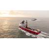
Early adopters have already been testing Geomatics, with the solution now being rolled out to several research vessels, including R/V Anna Weber-van Bosse, operated by NIOZ, the Royal Netherlands Institute for Sea Research, and Statsraad Lehmkuhl for the One Ocean Expedition (OOE).
Commenting on the latter, Geir Pedersen, Researcher and Member of OOE’s Scientific Committee, explains: “The One Ocean Expedition is once again setting sail and will be relying on Geomatics to catalogue the vast quantity of scientific data we collect with Statsraad Lehmkuhl. It’s vital to get a complete record of the data, while we keep control of data quality under the voyage. Researchers will benefit from seamless data access both onboard and onshore as they progress their vital work.”
As part of the roll-out, Kongsberg’s existing Marine Data Management (MDM) product will be merged into Geomatics. Existing customers will be offered an attractive migration package to upgrade to Geomatics.