Fugro Acquires Satellite Earth Observation Company
, a service provider for mapping and monitoring marine and freshwater environments through satellite earth observation.Adding EO technology to Fugro’s existing mapping solutions is a key step in the company’s strategy to further expand into the water market.EOMAP has been involved in satellite technology since 2006, holding several patented algorithms.The market for earth observation solutions is growing due to increasing environmental regulations, the need to address climate change impacts and the recognition of marine ecosystems' vital role in our planet’s health, says Fugro.Over
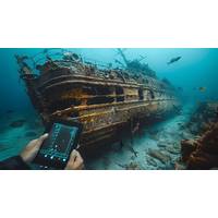
Billions in Lost Treasure: How Modern Technology Is Revealing Hidden Riches from the Depths!
are another essential tool, used to detect variations in Earth's magnetic field caused by large concentrations of metal likely found in shipwrecks -which alter its magnetic properties. When combined with sonar systems, treasure seekers can pinpoint exact locations of sunken vessels.Satellite technology has also become an invaluable asset when it comes to treasure hunting, offering clues as to where wreckage or debris fields have moved over time. Some treasure hunters use historical satellite images of hurricanes or storms which might have caused ships to sink - further narrowing search areas
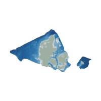
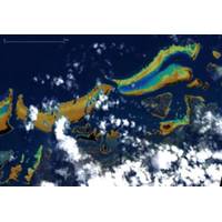
Danish Geodata Agency, EOMAP to Chart the Shallow Waters of Denmark.
By using Satellite-Derived Bathymetry (SDB), the Danish Geodata Agency and EOMAP are joining forces to contribute to the European Marine Observation and Data Network (EMODnet) Bathymetry partnership, and to integrate the SDB data into the Danish Depth Model (DDM).Using cutting-edge satellite technology, the cooperation will provide better mapping of shallow water areas lacking bathymetric coverage. This will also help improve the coverage of the DDM developed by the Danish Hydrographic Office, a part of the Danish Geodata Agency.“Finding new ways to map shallow waters, where we only
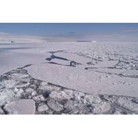
Record Low Antarctic Sea Ice is Another Alarming Sign the Ocean’s Role as Climate Regulator is Changing
change, but the trajectory of the global average temperature on the surface of the ocean has now entered uncharted territory – and fast.This graph shows global ocean surface temperatures, with the 2023 track at the top. climatereanalyzer.org, CC BY-NDWe know about the scale of this thanks to satellite technology that can sense small changes in temperature at the ocean surface.These surface data are just that: the temperature of the very skin of the ocean. To get a sense of warming in the deeper ocean, we use ship-based measurements and a fleet of underwater robots known as Argo.What satellites measure
Interview: Geir Håøy, CEO, Kongsberg
“56-fold” between now and 2050). Grounded in over half a century of offshore energy experience, he says the group already has a portfolio “spanning the renewables value chain” to help customers seize on opportunity. This includes solutions stretching from outer space, with satellite technology, to the deep sea, with hydroacoustic and subsea mapping innovations, while all periods of windfarm operational lifecycles are catered for, from surveying and turbine installation through to maintenance, life extension and decommissioning.“We’ve been involved in the industry from
Simple-to-use eDNA Test Will Help Track Marine Species
species, characterize harmful algal blooms, and explore our oceans” Gold said. “eDNA has the potential to revolutionize biology and resource management in the way remote sensing revolutionized agriculture, oceanography, hydrology, and weather forecasting. As with remote sensing and satellite technology, NOAA along with our federal partner agencies is helping lead the way on utilizing eDNA at scale”
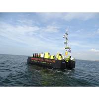
MATS, A New Uncrewed Platform for Offshore Wind
for remote operations. “Before we started developing a USV we started developing remote services in general and developed a standard piece of hardware and software to enable us to deliver reliably remote services,” says Marten. “Behind that is having secure communications. Satellite technology suffers from packet loss and delays over wide areas networks. The effect of that is, if you have a 5MB connection upload speed you might only be able to use 2MB of the bandwidth you paid for and bandwidth at sea is very expensive. We wanted to be able to use 100% of the network.”UTEC
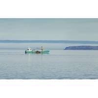
Smartphone App Aims to Help Commercial Fishing Reduce Bycatch
industry to report accidental wildlife catch (bycatch) alongside standard catch reporting and will help to record bycatch of important marine species such as dolphins and porpoises, seals, seabirds, sharks, skates and rays.The app's developer, AST Marine Sciences Limited, part of Applied Satellite Technology Ltd, says it hopes the technology will be used by scientists and the fishing industry to help understand which wildlife species are more likely to be caught accidentally and to reduce instances of bycatch overall.According to AST, less than 5% of commercial fishing activity is observed and
Drifter Buoys Aid Seaweed Research
Gary King, SPOT Regional Sales Manager EMEA at Globalstar. “Many hundreds of SPOT Trace GPS trackers are now involved in oceanography studies around the globe, helping drive informed decision-making on plastic pollution, oil spills and more, and we believe this scientific use of our reliable satellite technology will only grow further.&rdquo


