Coastline Surveys Completes Geotechnical Investigation for Navitus Bay
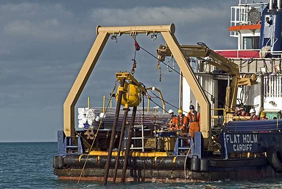
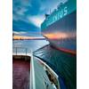
Photo: Coastline Surveys Ltd.
Coastline Surveys completed a geotechnical investigation of the seabed cable route at the proposed Navitus Bay offshore wind park, off the south coast of England.
Coastline Surveys, the Falmouth-based marine data consultancy, was chosen to extend previous phases of work as the main contractor. The team has provided geotechnical expertise to examine the viability of the proposed cable route that will transport energy from the wind park to shore.
Utilizing its 24-meter survey vessel, MV Flatholm, along with their C-COREHP vibrocorer, Coastline Surveys successfully completed sampling at 22 locations along the planned route for the cable. The route runs from the shoreline to approximately 12 miles off shore.
A key requirement for Navitus Bay was the acquisition of high quality samples for environmental and potential archaeological analysis.
On investigating the ocean floor, the team expected to find marine sands overlaying bedrock, with a range of depths throughout the area. It soon became clear that the site was made up of a variety of soil conditions ranging from soft silts to dense sand and clays.
Navitus Bay required undisturbed quality samples where possible, but particularly around the palaeochannels, where fine grained material and peat deposits were also expected.
Coastline Survey’s C-COREHP unit has a real-time Penetrometer fitted to it, to monitor the rate of penetration during sampling. This was especially invaluable in areas of softer loose sediments as it allowed the geotechnical team to recover high quality samples with reduced disturbance.
The stiff clays and dense sands that the team encountered presented a different kind of challenge. The class leading power and weight of the C-COREHP unit meant the team was able to achieve good depths in these conditions, penetrating the ground up to one meter into the underlying stiff clay in some locations. The penetrometer was particularly useful in these difficult conditions allowing the team to realize when they wouldn’t be able to recover any more sediment. As a result, the team was able to terminate their tests when appropriate, saving time and costs whilst preserving sample integrity.
Lab testing and reporting was completed at Coastline’s facility in Lowestoft. The Geotechnical logs, soil descriptions and core photography provided to Navitus Bay were of sufficient quality and standard to assist with identification of archaeological features.
www.navitusbaywindpark.co.uk