Fugro Maps Elevation in Texas River Basins to Bolster Flood Resilience
© Fugro
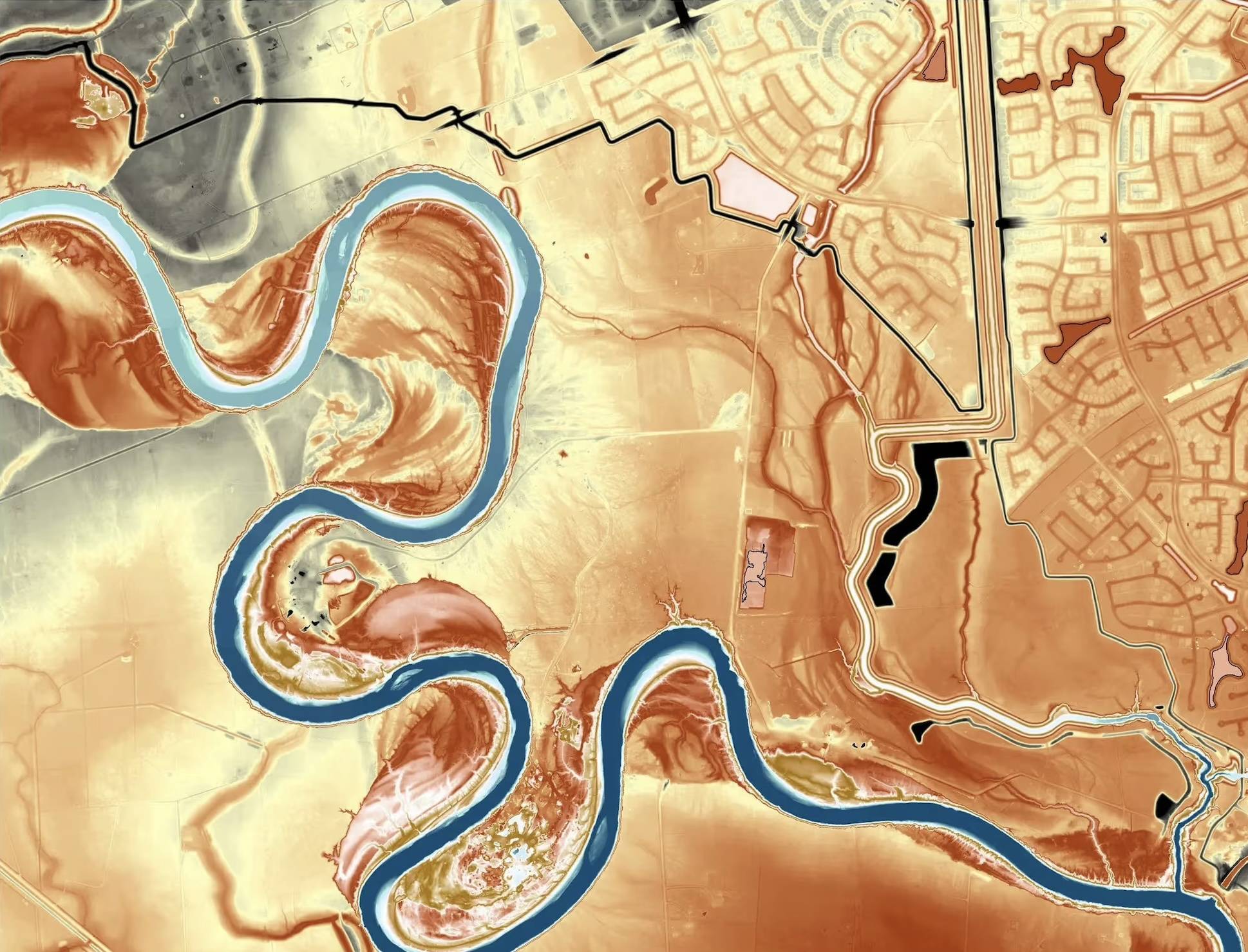
Fugro is undertaking an elevation‑mapping project to support flood‑risk and infrastructure planning across south central Texas. Commissioned by the Texas Water Development Board (TWDB), the work spans the Guadalupe, San Antonio, Lower Colorado, and Lavaca river basins, covering approximately 41,381 square kilometers across 34 rapidly growing communities. Many of these areas have faced repeated flooding in recent years, prompting local authorities to update hazard‑mitigation plans and improve drainage, transport and water systems.
The work is being delivered through the Texas Geographic Information Office (TxGIO), which provides geographic data used by agencies across Texas for planning and public‑safety applications. As a longtime partner of the Strategic Mapping Program (StratMap) at TxGIO, Fugro is using airborne lidar mapping methods to provide state and local partners with a view of the landscape as it exists today. To streamline data collection and improve data quality across the project area, the approach uses satellite positioning to reduce the need for new ground reference stations, while Fugro’s cloud‑based processing systems help accelerate data delivery to the state.
Aerial data collection began on January 10, 2026 and was completed on February 16, 2026. Fugro will deliver mapping products to the state in stages through January 2027. Once data is reviewed and approved by the state, the new elevation dataset will be released for public use through the TxGIO DataHub.