New Monitoring Network for Scottish Ports


-
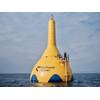
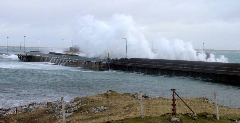 Photo: OTT
-
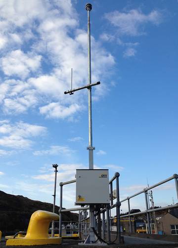 Photo: OTT
-
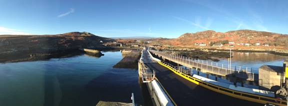 Photo: OTT
-
 Photo: OTT
-
 Photo: OTT
-
 Photo: OTT
-
 Photo: OTT
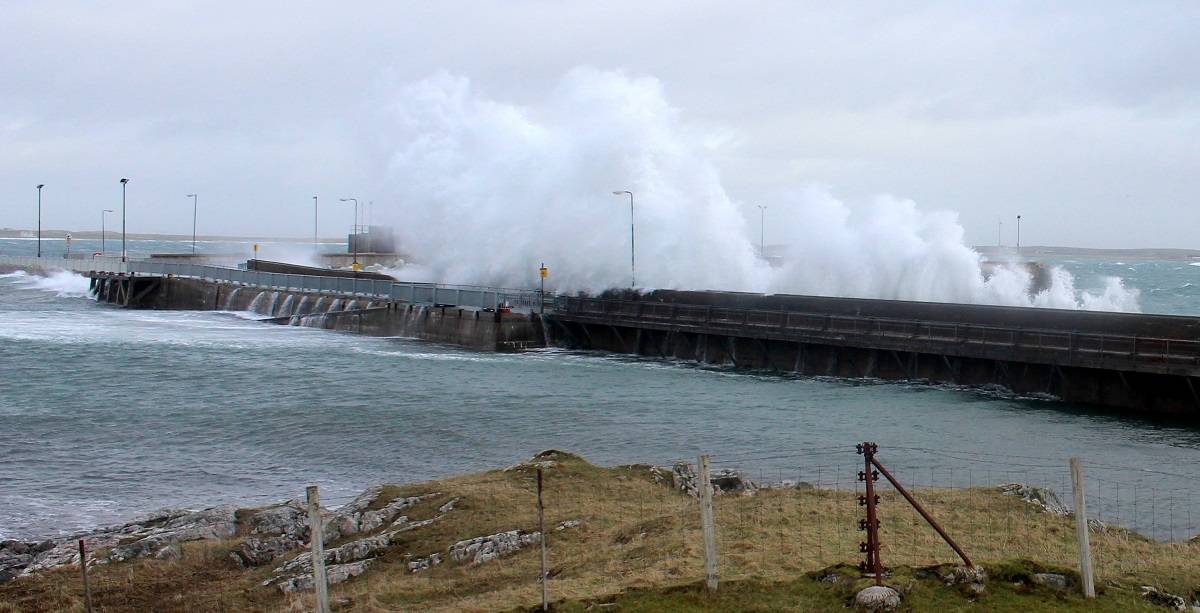

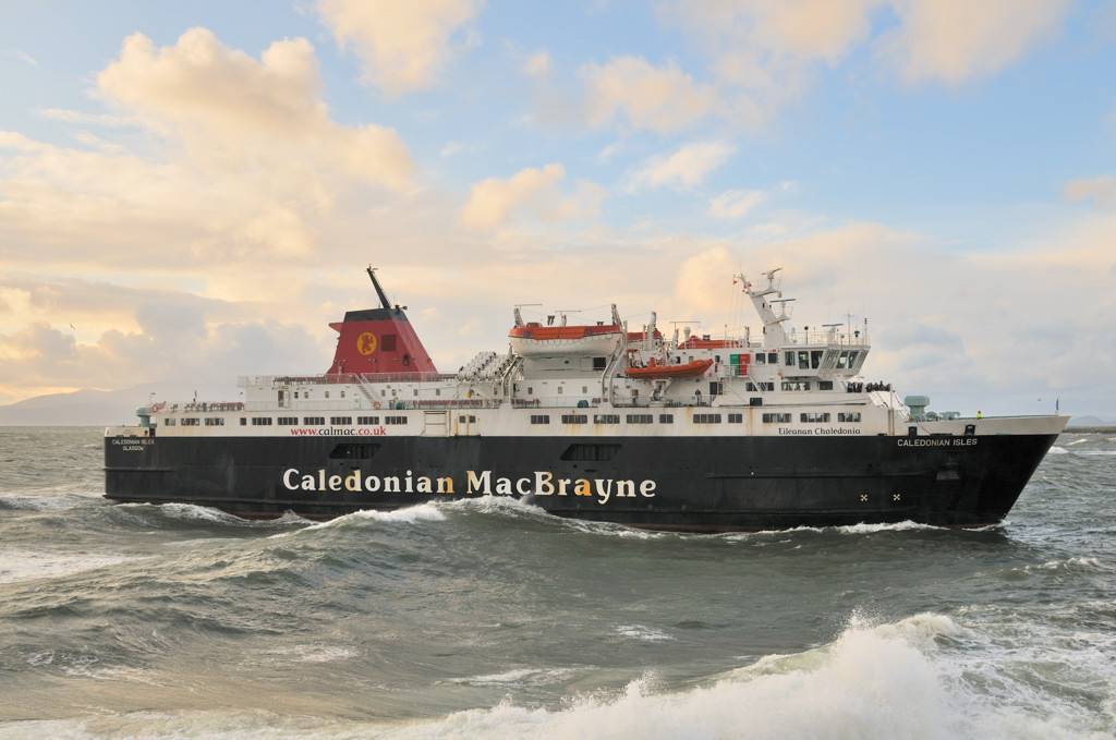
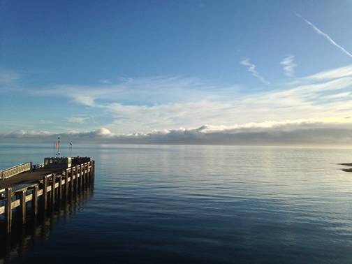
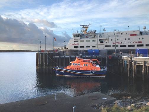
Historically, ferry masters operating off the west coast of Scotland would have to sail to a port and on arrival visually assess the weather and tide conditions before deciding whether safe berthing alongside the pier or quayside would be possible. This wastes time and fuel, and can causes frustration among passengers, who may see ferries come close to a port, but thereafter depart without berthing when conditions are determined by the ferry Master to be unsafe. These ferries provide a lifeline service to the islands, so the reliability of ferry services is important.
With multiple sites in island locations, remote access to accurate local data providing live information on tide level and key climatic conditions could facilitate improvements to the service by aiding the masters to make a more informed decision at an earlier stage in the voyage – in some instances even before departing the previous port or harbor. The berthing of ferries is a highly skilled job, particularly during bad weather, and the decision on whether a specific ferry can safely berth at a specific port is subjective and ultimately can only be taken by the ferry master.
Following a competitive tendering process Caledonian Maritime Assets Limited (CMAL), which owns many of the ferries, ports and harbors in the region, procured a network of 15 tide and weather stations from instrumentation specialist OTT Hydrometry. The new monitoring equipment provides live data on port conditions to enable the ferry sailing decisions to be made in a timely manner.
CMAL Harbor Master David McHardie said, “OTT installed the first monitoring station in August 2014 and the network is now almost complete with sensors providing data every 1 minute via UHF radio to ‘gateways’ in the ferry offices, which then submit the data via the internet to a central server, which can be remotely accessed by authorized users.
“We have a regulatory requirement to monitor the tide level in our statutory harbors, but this system also provides essential weather information for our ports. In the past, these measurements were taken manually, so the availability of continuous multiparameter data is an enormous improvement – not just in the quality and value of the information, but also in the safety benefits for harbor operations staff, that this provides.”
The safety considerations involved with the berthing of ferries relates not just to passengers and crew but also to the pier hands that assist with mooring operations in a wide variety of often extreme weather conditions. “Mooring operations are inherently high risk activities; handling ropes can become extremely heavy when wet and subject to enormous forces when under strain,” McHardie said. “So, it is important for us to be able to assess the impact of wind, temperature and waves to protect harbor operations staff. Severe weather berthing conditions can also potentially cause damage to ferries and the structures within the ports, so again, detailed data on localized conditions can help prevent accidents and support insurance claims when necessary.”
The availability of live data on port conditions therefore enables the ferry masters to make better informed decisions at an earlier stage, thereby saving time, fuel and costs. It also means that passengers are provided with earlier warnings of potential ferry cancellation.
Emphasizing the growing need for data, McHardie said, “In recent years, severe weather events appear to have become more frequent and they seem to develop faster; for example, since the monitoring network was installed, we have recorded a sudden drop in temperature of 8°C in just 5 minutes at the port of Armadale on the Isle of Skye, and a maximum wind gust of 96 knots at Castlebay on the Isle of Barra. These conditions represent a rapid deterioration of conditions and the monitoring network enables us to respond quickly and effectively.”
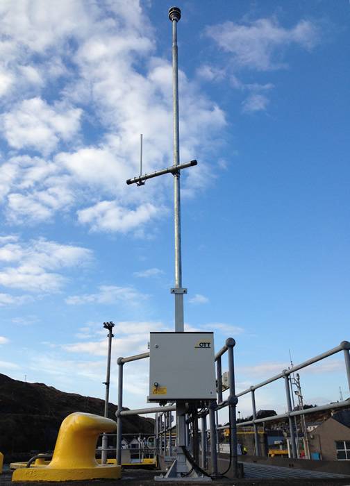
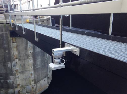
Each monitor is located adjacent to the main berthing area on the pier with a lockable GRP control box. The system is comprised of: an OTT radar level sensor; a Lüfft ultrasonic weather monitor measuring wind speed, gust and direction, air temperature and barometric pressure; an Adcon radio unit with back-up batteries and a marine grade antenna. The radar tide level sensor is an OTT RLS, a noncontact sensor employing pulse radar technology with a large 35m measurement range. Both the RLS and the weather sensors, which have no moving parts, have extremely low power consumption, which is vitally important for installations at remote sites. At two locations it was not possible to install a radar sensor so an OTT CBS (bubbler sensor) was installed providing comparable levels of accuracy and reliability.
Robin Guy managed the monitoring network project on behalf of OTT Hydrometry. He said, “We were obviously delighted to be awarded this contract; it’s a good example of the bespoke monitoring systems that we are able to develop, integrating our sensor, datalogging and telemetry technologies to meet customers’ specific needs.
“Before awarding the contract to OTT, McHardie visited four of our existing installations at the Greenock Ocean Terminal near Glasgow to check the reliability of our equipment in demanding conditions. However, in addition to the ruggedness of this equipment, it has also been designed to cope with interruptions to the mains power supply. The monitors are therefore battery powered and data is transferred from the monitors to the port office gateway via low power radio.”
Now that the CMAL monitoring system is installed, McHardie is looking for ways to leverage the value of the data. For example, radio data transmission works very well over water, so it should be possible to fit the same technology on ferries so that the ferry masters can access the data directly, instead of having to call the port office for a verbal update. The OTT monitoring network also incorporates an email alert system, and whilst this has not yet been configured, it will be possible in the future for ferry masters to receive email alerts warning them when prespecified port conditions arise. “We would also like to eventually make the data available to the public as part of an enhanced harbors information system,” McHardie said. “However, when a ferry has berthed, with the monitoring system being located on the pier, the vessel can cause a wind shadow; which means the wind data during that period can be potentially misleading. It has to be remembered that this system remains only an aid to navigation.”
Summarizing, Guy said, “This system demonstrates the value of remote monitoring data, but also highlights the importance of low power, rugged, reliable instruments in harsh environments. The modularity of the system is also very important because it enables us to deploy the most appropriate instruments in each individual location.”