Satellites Help NOC Track Tidal Change for Safer Port Operations

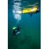
Scientists at the UK’s National Oceanography Centre (NOC) in Liverpool have used satellite data to create a unique insight into the iconic Mersey River that will help port operators be smarter about managing complex navigation channels. Credit: NOC
Scientists at the UK’s National Oceanography Centre (NOC) in Liverpool have used satellite data to create insight into the Mersey River that will help port operators be smarter about managing complex navigation channels.
Through a project focused on Liverpool’s famous river and funded by the UK Space Agency, NOC’s scientists showed that changes in areas exposed at low tide can be mapped from space.
The project, run in partnership with the Channel Coastal Observatory (CCO) and Peel Ports Group, means port operators could now pre-empt sand or mud moving and blocking their navigation channels, reducing larger remediation works.
It can be expensive and difficult to monitor an estuary of this size regularly enough to keep up with the continual changes in sandbank and channel positions using the standard survey methods that use survey boats or light aircraft. However, maintaining rivers like the Mersey, which handles more than 60 million tons of freight a year through Peel Ports Group, is important for safe and efficient port operations.
“Gaining an understanding of these areas is helping us to enhance the way we manage navigational safety and dredging strategies," said Russell Bird, Deputy Group Harbour Master (Hydrographic and Dredging), at Peel Ports Group. "The findings that NOC has achieved has showed us the potential to manage significant changes in the river more proactively.”
The project analyzed data from optical and radar satellite images combined with information from the Gladstone Tide Gauge, which sits within the Old Lock Keeper's Office at the entrance to Gladstone Dock, in Liverpool. These were further combined with fine scale water level data from the new Surface Water and Ocean Topography (SWOT) satellite, launched in December 2023 that enabled more precise estimates of tidal water levels right across the estuary.
The analysis enabled the team to map changes in the riverbed from 2018 to 2023. These maps then provide a clearer picture of how the river is evolving, helping experts plan dredging operations more effectively and avoid unnecessary costs.
The success of this project builds on years of research and development funded across multiple projects and puts Liverpool at the forefront of using such technology to address challenges in coastal management, with the potential for these methods to benefit other parts of the UK in the future.