Marine Technology News Search
Search term • "advanced navigation"
Create an email alert for "advanced navigation"
HydroWing Technololgy Works, says Dadd
Inyanga Marine Energy Group completed hydrodynamic testing of its Passive Pitch Unit for its patented HydroWing technology, which was recently awarded the largest tidal energy project in the UK in Allocation Round 6 of the UK government’s Contracts for Difference scheme and the company is now on course for deploying a 20MW tidal energy project at Morlais in Wales, in addition to other projects around…
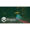
Underwater Infrastructure Big Data Project Secures €2.4 Million Grant
Geospatial cloud specialist north.io has been awarded a €2.4 million grant for the "Argus" project for underwater big data analytics in the context of critical underwater infrastructure, marking the highest single funding the Kiel-based company has ever received.The grant is provided by the Federal Ministry for Digital and Transport (BMDV), as part of the mFUND innovation initiative, contributing to…

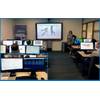
SPE Aberdeen: Tackling the Offshore Design Challenge
An engineering expert is set to talk at a Society of Petroleum Engineers’ (SPE) Aberdeen Section presentation this month, discussing the challenges associated with the analysis and design of offshore engineering equipment. Offshore marine equipment can be physically complex, expensive, safety critical and required to operate in harsh environments. This means that regulations for design and manufacturing processes can differ based on a number of factors…
Greensea Launches Hull Cleaning Spin-off Armach Robotics
Marine software pioneer Greensea Systems Inc. has launched spin-off company Armach Robotics, that capitalizes on Greensea’s digital expertise to offer a subscription model robotic hull cleaning system using autonomy, intelligence and data fusion to tackle biofouling.Armach Robotics is not a technology company and does not sell robots; it is a service provider offering a subscription for clean hulls and hull intelligence.
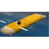
Autonomy: iXblue ramps up DriX USV Production
iXblue has been ramping up its production of DriX Uncrewed Surface Vehicles (USV) to meet the growing need for efficient and sea-proven autonomous platforms.With more than 20 DriX in operation worldwide, iXblue USV, that was launched back in 2017, has already been acquired, deployed or trialed by several industrial companies and scientific institutes for seabed mapping missions and other subsea positioning operations…
POJL Upgrades to SBG Marine Navsight Solution
Ports of Jersey upgraded its existing SBG Apogee-U to the Apogee Navsight Solution which has been designed specifically for marine applications. Swathe Services, who supplied and installed the original system, assisted with the upgrade and servicing by SBG Systems.The port purchased the Apogee-U high-performance Inertial Navigation System (INS) from Swathe in 2016 along with a high resolution R2SONIC…
IBM Joins Mayflower Autonomous Ship Project
International technology giant IBM has joined a global consortium of partners, led by marine research organisation ProMare, that are building an unmanned, fully-autonomous ship that will cross the Atlantic on the fourth centenary of the original Mayflower voyage in September 2020.A new Mayflower will set sail 400 years after the historic voyage, this time using AI and other advanced technologies, the American IT major said.The Mayflower Autonomous Ship (MAS) will use IBM’s AI…
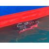
Hull Inspection Systems Delivered to the US Navy
Bluefin Robotics has delivered new vehicles to the U.S. Navy that aim to increase the Navy's capability to remotely search and investigate ship hulls, harbor sea floors and other underwater infrastructure for limpet mines, Improvised Explosive Devices (IEDs) and other objects of interest. The Navy accepted delivery of Bluefin Robotics’ ship hull inspection systems 4 and 5 under the “Explosive Ordnance Disposal…
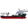
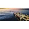
Delta SubSea Secures New Build Olympic Delta
Delta SubSea, LLC has entered into an agreement with Olympic Shipping AS for the Olympic Delta, a newly built multipurpose subsea support and construction vessel. The Olympic Delta is a GREEN Vessel designed according to DNV class, with high focus on reduced fuel consumption, which also means lesser emission to the environment. The vessel is equipped with two Delta SubSea Schilling HD 150 HP work-class remotely operated vehicles (ROVs) from DSS’s fleet.
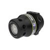
Updated SeaLite Sphere LED Light
The SeaLite Sphere has evolved to offer field-serviceable connector replacement for a quick and easy repair in the field. The SeaLite Sphere advances beyond other LED lights by separating the connector from other internal electronic components to avoid downtime and costly repairs due to connector failures. The 8,700 psi pressure resistant compartment separates the connector and the rest of the light; which will make flooding due to a connector failure a thing of the past.
Teledyne Brings Bathymetic Solutions to CHC-NSC
Teledyne CARIS and Teledyne Optech will have a combined presence at the 2018 Joint Canadian Hydrographic and National Surveyors Conference in Victoria, British Columbia, March 26-29. Visitors interested in the latest in ocean mapping software, and the swift progress taking place in lidar surveying and mapping solutions can drop by stand 407 to learn more. Teledyne CARIS is offering a half-day workshop on March 26th at 1pm.
Oceaneering Demos AUV for US Navy and Defense Innovation Unit
Oceaneering International, Inc. said its Subsea Robotics segment recently completed a one-week autonomous underwater vehicle (AUV) demonstration for the U.S. Navy and Defense Innovation Unit (DIU) at Oceaneering’s subsea autonomy testing facility in Norway.During the week, Oceaneering demonstrated its portfolio of capabilities to design, engineer, operate and maintain the Freedom AUV, which was picked…
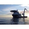
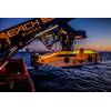
Reach Subsea Extends Olympic Taurus Charter and Orders Two ROVs
Norwegian company Reach Subsea has extended the charter for the Olympic Taurus subsea vessel and ordered two new Constructor-type remotely operated vehicles (ROVs) from Kystdesign.Back in February, Reach Subsea announced a 100-day project charter for the subsea vessel Olympic Taurus, with extension options for 2+1+1 years.The company has now extended the charter for an additional two years and retain…
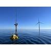
Venterra Geoscience On Call for Nova Scotia’s Offshore Wind
Venterra Group, the global offshore wind services company, has secured a contract to assess metocean data collection needs that will assist with offshore wind farm development off Canada's Atlantic Coast.Amidst a surge in interest in offshore wind power, Canada hopes to harness its expansive wind resources to fulfil its clean energy and climate ambitions, with Nova Scotia planning to offer seabed leases…
High-speed ROV Accelerates Mapping, Surveys
MMT, specialists in high-resolution marine surveys, has completed offshore integration trials of its new high-speed remotely operated vehicle (ROV) with Sonardyne International’s SPRINT inertial navigation system. The 2,000 meter rated vehicle, named Surveyor Interceptor, has been developed by MMT to improve the speed and efficiency of seabed mapping and pipeline inspections surveys. Its design features…
NASA to Further Develop Titan Submarine Design
Step forward the Titan Submarine, a proposal that NASA has just awarded a second round of funding through their Innovative Advanced Concepts (NIAC) program. It is very much just a concept at the moment, but it is promising nonetheless. Aside from Earth, Titan is the only place in the solar system that has bodies of liquid on its surface, making it a rather attractive place to explore. But while a number of proposals have been put forward to take a closer look, none have come to fruition.
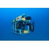
Tiburon Subsea Upgrades ROV Otis
Tiburon Subsea Services Inc. selected GreenSea Systems Inc. to supply its new controlling and operating system for science class ROV Otis. GreenSea Systems develops automation and navigation for unmanned underwater vehicles. The new control, navigation and station-keeping upgrades being added to OTIS will make the vehicle one of the most versatile ROVs of its size available for rent, Tiburon Subsea said. The custom 600 meter ROV offers low power consumption, excellent optics and sensors.
NOAA to Boost Arctic Nautical Charting
NOAA plans increased 2015 Arctic nautical charting operations, coordinating with U.S. As commercial shipping traffic increases in the Arctic, NOAA informs it is taking steps to update nautical charts in the region. NOAA’s Office of Coast Survey will use data collected by two of its own ships, Rainier and Fairweather, as well as the U.S. Coast Guard cutter Healy and a private sector hydrographic contractor to cover nearly 12…
Kraken Delivers Deep-Sea Sonar System to IOSB
Kraken Sonar Systems Inc. has delivered a deep-sea rated Interferometric Synthetic Aperture Sonar (INSAS) system to Germany’s Fraunhofer Institute for Optronics, System Technology and Image Exploitation (IOSB), the company announced today. Fraunhofer is the leading organization for applied research in Europe. Under the terms of the contract, Kraken has successfully designed, engineered and delivered a 6…
Teledyne TSS Launches New Gyrocompass
Teledyne TSS is launching the latest addition to its Saturn product range at the Ocean Business exhibition with the introduction of its fiber-optic marine gyrocompass. This is an entirely new product from the gyro-compass manufacturer. It is specifically aimed at the commercial shipping, fast ferry and superyacht markets. The new Saturn gyro also includes attitude reference capabilities which make…


