Series of High-res Surveys to Track Changes in Thames River

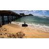
Anchor and lumber on the bottom of Thames River near New London ferry docks (Image: ThayerMahan)
A two-year project aims to locate and monitor the shifting boundaries of key biological habitats and short-term, small-scale changes in bathymetry important to the health of Connecticut’s Thames River and Long Island Sound ecosystems.
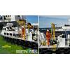
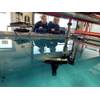
Marine technology company ThayerMahan, which recently completed an underwater survey using its SeaScout system to capture high-quality hydrographic imagery of the river, said the survey is being conducted under a National Institute for Undersea Vehicle Technology (NIUVT) project in conjunction with the University of Connecticut (UConn)’s Department of Marine Sciences.
ThayerMahan’s SeaScout system is an actively stabilized towed vehicle with synthetic aperture sonar and multibeam echosounder payloads. The system generates ultra-fine resolution (3cm x 3cm) beamformed imagery and interferometric bathymetry of undersea cables, boulders, rocks, and seafloor characteristics in real-time.
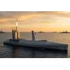
The survey was performed aboard the R/V Connecticut, a research vessel owned by UConn. The Undersea Warfighting Development Center and the Naval Submarine Base New London were important contributors to the project. The next survey is planned for May 2021.
Over the course of the two-year project, baseline data will be reevaluated to identify changes in the region and enhance security within the New London port area.
Michael Connor, ThayerMahan’s president and CEO, stated, “This project, leveraging ThayerMahan’s ability to rapidly gather high-quality imagery in real-time, is an important step toward safely developing the Blue Economy offshore and enabling the safe and secure use of our harbors by commercial and government vessels. All ships, particularly those carrying environmentally sensitive cargoes and munitions, should be able to operate in restricted waters confident that neither obstructions nor threats lie in their path. Our seabed imaging capability can make that a reality today.”