Safe Software & CARIS Partner to Ameliorate CSAR Framework
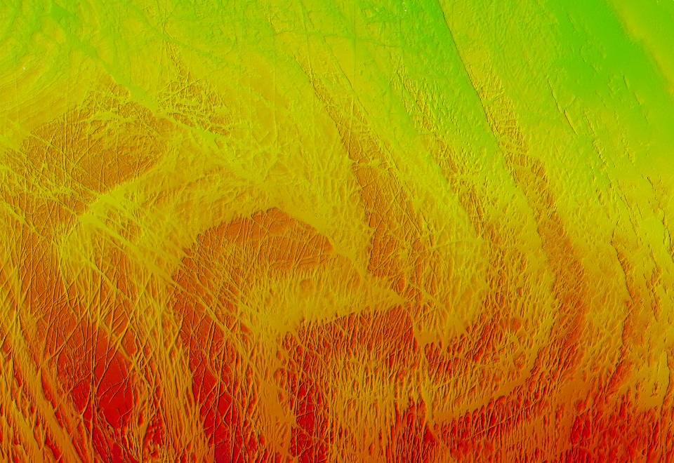
High resolution bathymetry displayed in CSAR format of the major faults north of Chirikof Island: Image courtesy of NOAA.
Safe Software and CARIS say that support for the CARIS Spatial Archive (CSAR) raster format for gridded bathymetry and elevation data will be included in FME 2014, available already in the beta and scheduled for official release in January 2014.
As a result of this collaboration, FME users will now have direct access to the cutting edge data storage technology designed by CARIS for efficient storage and visualization of high volume raster data. FME 2014 can now read and write CSAR raster files, and can also read raster data directly from CARIS Bathy Database (BDB), allowing CSAR rasters to be transformed and manipulated in FME workflows.
“The inclusion of CSAR raster support in FME allows high density bathymetric surfaces to move easily between different formats and GIS systems,” says Mark Masry, Senior Development Manager at CARIS. “This is a significant milestone for CARIS since it will provide users of our software with a huge number of integration and data transformation possibilities. We’re really excited to see what they’ll do with this.”
“We love participating in collaborations like this,” says Don Murray, President and Co- CEO of Safe Software. “Not only are we increasing data accessibility for CARIS users, but we’re also giving FME users access to another great tool. FME is all about giving users the choice to use any tool they want.”
About CARIS
Established in 1979, CARIS is a leading developer of geospatial software. The CARIS Ping-to-ChartTM product line delivers an integrated software solution for the entire workflow of hydrographic information from the echosounder "ping" through to the production and distribution of the "chart".
In the picture: High resolution bathymetry displayed in CSAR format of the major faults north of Chirikof Island.