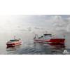
NOAA Ship Thomas Jefferson Returns to the Great Lakes to Map the Region
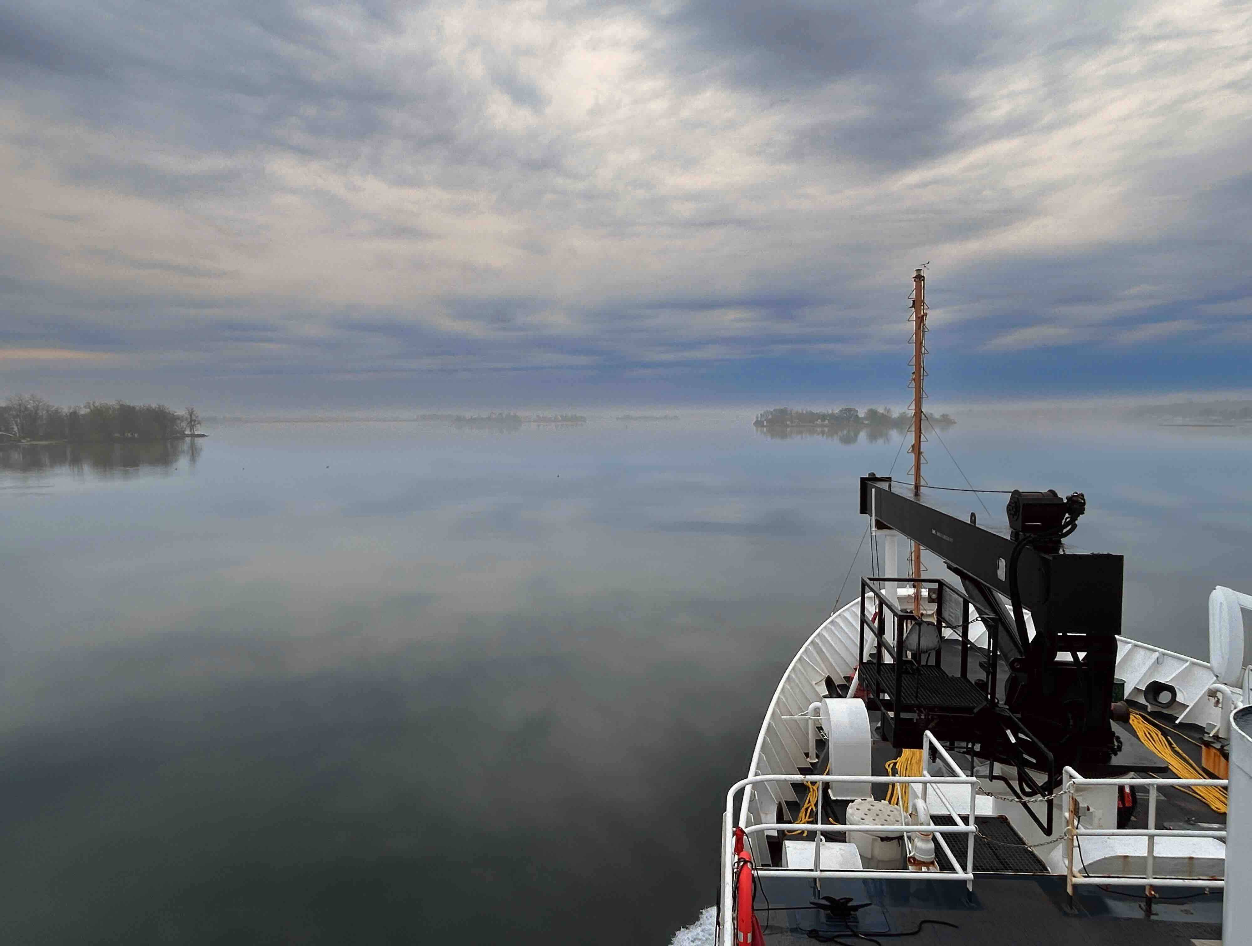
Misty morning in Thousand Islands, seen from the upper deck of the Thomas Jefferson. (Megan Guberski/NOAA)
For the first time since 2022, the NOAA Ship Thomas Jefferson is underway in the Great Lakes. The vessel and its crew of NOAA Corps officers and professional mariners are working with NOAA scientists to map the waters of western and central Lake Erie and eastern Lake Ontario this year to improve navigation safety. Survey work will also occur within Lake Ontario National Marine Sanctuary to identify critical habitats located within the area.
Western Lake Erie, one of the shallowest areas within the Great Lakes marine transportation system, is highly trafficked by commercial and recreational vessels and has not been surveyed since the 1940s. NOAA’s nautical navigation products and services from seafloor mapping surveys are critical for a safe, and secure ocean economy. These tools reduce collisions, identify dangers to navigation, and facilitate more efficient and successful fishing operations.
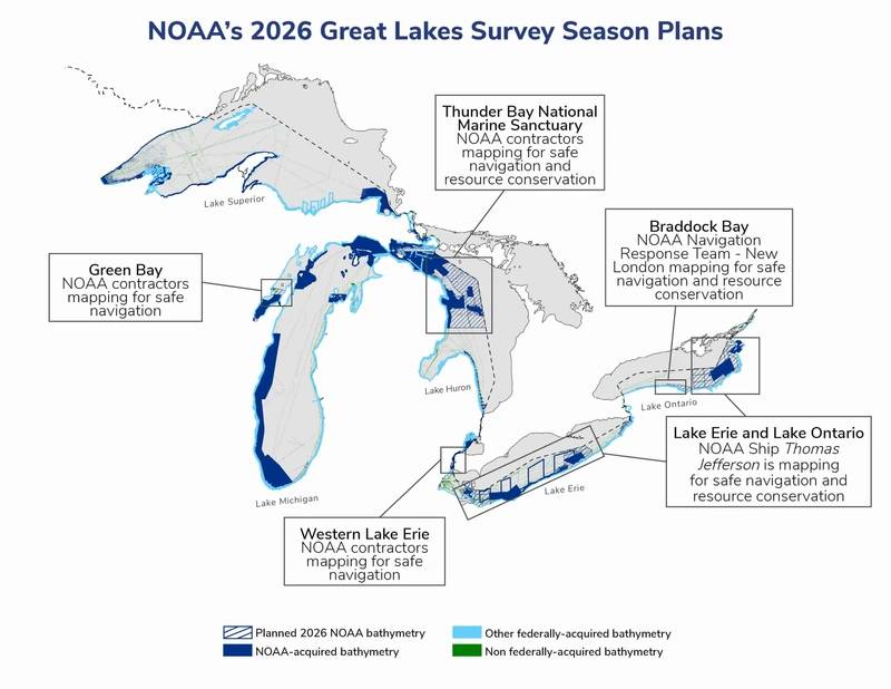 NOAA’s Great Lakes survey season plans for 2026. © NOAA
The Great Lakes are the least mapped region of the U.S., making this work even more important for mariners in the region. In addition to operations on larger vessels like the Thomas Jefferson, NOAA also maps critical areas of the Great Lakes each year using navigation response teams. This year, those teams will map Thunder Bay National Marine Sanctuary; western Lake Erie; Braddock Bay and Vicinity, New York; and Green Bay, Michigan and Wisconsin. Follow along with each survey’s progress here.
These projects also contribute to the collaborative Lakebed 2030 initiative to map the Great Lakes, as well as the Great Lakes Restoration Initiative’s habitat mapping program.
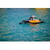
This summer, the Thomas Jefferson will augment operations with a DriX, an uncrewed surface vehicle near Oswego, New York to accelerate mapping efforts. The DriX is equipped with high-resolution multibeam sonar, used to map the seafloor and detect objects in the water column or along the seafloor. The DriX is operated using “supervised autonomy,” meaning that a NOAA pilot is always monitoring the system and ready to take control if needed. The system is capable of operating for upwards of four days at a time before returning to shore for routine checks and refueling.
Dive deeper into U.S. ocean, coastal, and Great Lakes mapping
Did you know that today only 17% of the Great Lakes are mapped? The seafloor is constantly shifting. Weather, currents, and melting ice up north shift the seafloor and bring in new obstructions–plus debris and shipwrecks all change the seafloor. NOAA’s Office of Coast Survey acquires and processes the nation's bathymetry and is the authoritative source for all offshore depth data within the United States' Exclusive Economic Zone (EEZ).
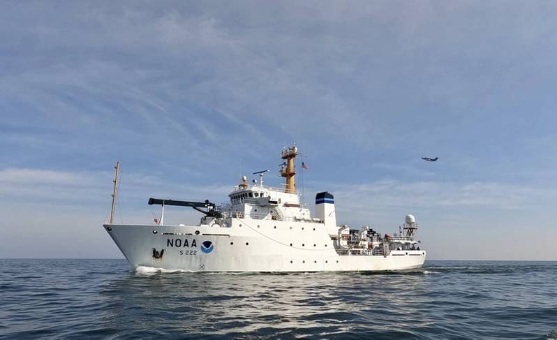 NOAA Ship Thomas Jefferson mapping off the coast of Cleveland, Ohio, in 2022, along with a NOAA plane collecting lidar data. (Credit: LCDR Michelle Levano/NOAA)
Coast Survey’s primary mission is safety of navigation, ensuring the trillions of dollars in imports and exports, U.S. military, and recreational boaters transit safely across U.S. waters. Seafloor mapping data has uses well beyond nautical charts–storm surge models, for example, rely on understanding how much water is in a given area, and fisheries and marine sanctuaries need updated data to better classify and understand their waters.
To identify the highest priority survey areas, Coast Survey uses a hydrographic health model, a risk-based model that takes into account navigational risks, including both the likelihood of a risk (e.g., traffic density, known hazards to navigation, reported ship groundings) and the consequence of a risk (proximity to search and rescue stations, proximity to reefs or marine sanctuaries, etc.). The model also considers the necessary quality of data to support modern traffic relative to what is currently available, given the seafloor changes over time. To see what other projects Coast Survey is embarking on in 2026, view the survey season’s website.