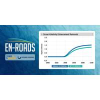
Marine Carbon Dioxide Removal Tool Added to Climate Solutions Simulator
users to test scenarios, compare outcomes, and explore tradeoffs. The feature, based on climate models, was developed by Climate Interactive in close partnership with Ocean Visions and its deep network of experts.Unlike highly specialized technical models, the En-ROADS Simulator was designed to engage diverse users across sectors without requiring modeling expertise. En-ROADS has been used by more than 1.5 million people worldwide, supported by a network of more than 960 Climate Ambassadors in 91 countries. Between 2022 and 2025, simulators from Climate Interactive and MIT Sloan informed 58 government
NOAA Atlantic Scientific Review Group Opens Nominations
particular, expertise required to provide adequate review and knowledgeable feedback on current or developing stock assessment issues, techniques, etc. In practice, this means that each member should have expertise in more than one topic as the species and scientific issues discussed in SRG meetings are diverse; and No conflict of interest with respect to their duties as a member of the SRG. Next StepsFollowing review, nominees who are identified by NMFS as potential new members must be vetted and cleared in accordance with Department of Commerce policy. NMFS will contact these individuals and
Digging Deeper: Challenges and Trends in the Dredging Industry
Dredging, like all sectors of the maritime industry, is experiencing rapid evolution, accelerated by increased demand and diverse challenges. Projects for waterways, infrastructure and submerged utilities grow more complex every year, and thus dredging companies must meet industry needs while ensuring awareness of and compliance with all relevant safety standards.The problem(s)The obstacles facing the dredging industry are not brief, nor are they simple. They range from submerged utility strikes and infrastructure protection to workforce shortages, injury prevention, regulatory coordination and
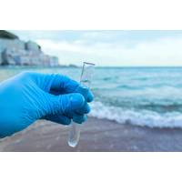
World Ocean Assessment Report Highlights Changing Chemistry
biological studies.For now, the acquisition of real-time or near-real-time data is skewed towards physical variables rather than biological variables, with biochemical variables falling somewhere in between. This imbalance is due to the complexity of the biological components of marine ecosystems, the diverse nature of their variables (e.g. taxonomic, ecological and physiological), the lower number of sensors developed for biological variables and the energy consumption required for image acquisition systems and active acoustic sensors.Long-term monitoring and observation systems are needed to understand
Ocean-Bottom Seismometers Play Crucial Role in Offshore Sensing
land-based sensors alone.But positioning them and, crucially, recovering them to download their data, then getting them ready for the next deployment, isn’t simple, especially when locations range from ice-covered Arctic waters to 4,700 m deep abyssal plain. And because the NSFI team relies on diverse “vessels of opportunity," from small fishing boats to ice-rated trawlers and large coastguard ships, and operates with a very small field staff, their choice of underwater positioning also has to be flexible.Deployment in January in New Zealand. Photo from NFSI. The solutionThe ideal
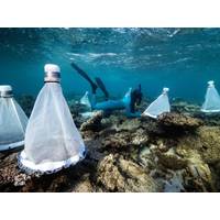
Millions of Coral Larvae Released at Nyinggulu
spawning and larval development times for Nyinggulu, including locations that were previously unrecorded.“We’ve also successfully demonstrated that large-scale, reef-based mass larval production and release of coral larvae is a feasible option to support regeneration on Nyinggulu’s diverse reef systems.”Given coral takes years to grow, the results of the trial won’t be known for a couple of years. Project Director for the Nyinggulu trial Dr Jenny Shaw, says there is no doubt this year’s spawning process has been given an advantage, and that trial has created a new

UK Hydrographic Office Launches Digital Format for ADMIRALTY Sailing Directions
of indicative routes within the geo-display enables more dynamic passage planning, simplifying access to key routing information. Intuitive by design ADSD has been developed in close consultation with navigating officers from around the world, including testing across a diverse range of vessel types and navigational scenarios. In a survey of more than 50 mariners who used ADSD:88% of users said ADSD was intuitive and easy to use 91% of users agreed ADSD’s geo-display made sailing directions easier to understand 88% of users said ADSD saved
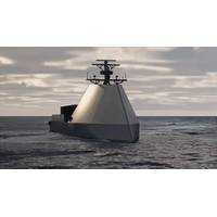
U.S. Navy Selects HII USV to Advance to At-Sea Testing
;HII’s Odyssey Autonomous Control Solutions (ACS) is currently deployed on REMUS unmanned underwater vehicles (UUVs) and ROMULUS USV platforms in 30 countries, transforming vehicles into intelligent robotic systems. Through flexible vehicle-, module-, and algorithm-level implementations across diverse platforms, sensors, payloads, and mission profiles, Odyssey Advanced Autonomy Solutions deliver multi-vehicle collaborative autonomy, sensor fusion, and advanced perception capabilities.The ROMULUS family of Unmanned Surface Vessels is designed to meet the current and emerging requirements of the
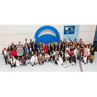
International Youth Ocean Leadership and Advocacy Program Arrives in Poland
for young scientists, students and early-career researchers.Participants will share research, ideas and perspectives across humanities and social sciences, as well as natural and physical sciences. The program also includes a dedicated session on inclusiveness in science, highlighting the importance of diverse voices and accessible research environments.Selected contributions will be published in registered conference proceedings with ISBN and recognized with awards for outstanding work