CTO in Focus: “Stop, Listen & Think” - One-on-One with Shepard Smith, XOcean
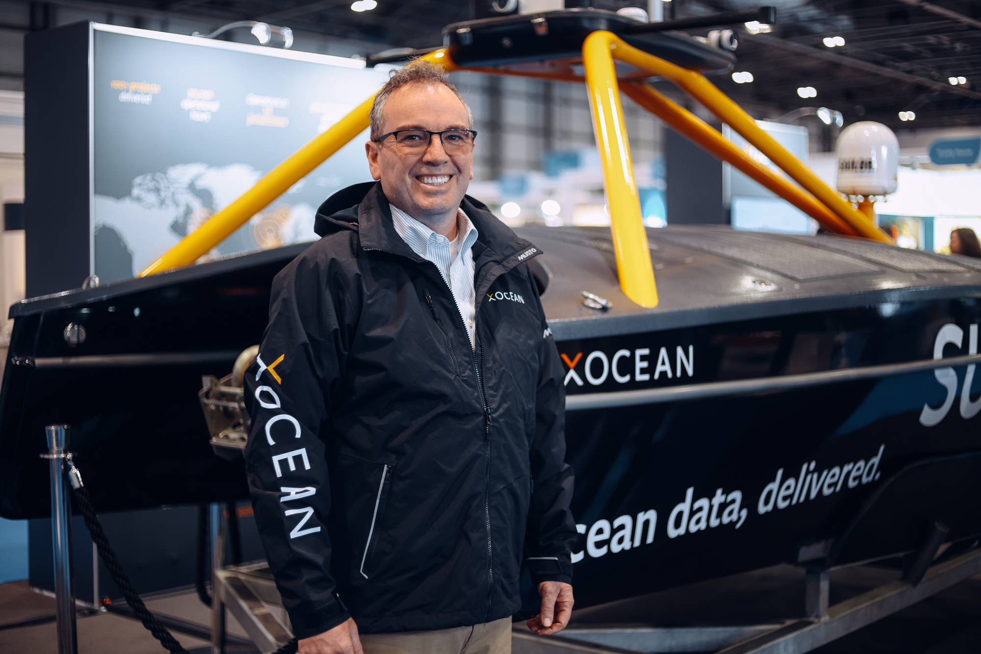
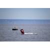
Photo courtesy XOcean
From his nearly three-decade career at NOAA to hiking the Appalachian Trail, Shepard “Shep” Smith brings a broad base of experience and expertise to his new post as Chief Technology Officer of XOcean. We checked in with Smith for his insights on technical drivers in the ocean exploration space, as well as what to expect from XOcean in the coming years.
- Shep, to start us off, please give an overview of your 28-year career at NOAA.
I was with the Commissioned Officer Corp part of NOAA. I started off in the hydrographic program assigned to the NOAA Ship Rainier up in Alaska, and we surveyed using survey launches and single beam echo sounders, as well as a ‘brand new’ technology – GPS – around the unexplored areas off the coast of Alaska. The next 10 to 15 years of my NOAA career was technology focused, working on integrating new technology, bringing in GIS and multibeam and database-based systems in through grided bathymetry to speed up our workflows. I also got into the charting side; and I was the chief of our charting division. I finished my career as the Director of the Office of Coast Survey and the U.S. National Hydrographer. Some of my most memorable times were the 10 years that I spent at sea, including four years as the commanding officer of the NOAA Ship Thomas Jefferson. But through it all, I was driving toward bringing new technology to improve the science and art of hydrography at sea.
- Before we dive into your new role at XOcean, I’d like to get a little background on the ocean exploration market, as you see it. What technologies do you count as to have the single biggest influence on studying the oceans more efficiently, more safely, and why?
I’m going to date myself, but GPS was not widely available when I first started. We take it for granted now that we can position our sensors accurately. That used to be the biggest difficulty, and frankly, the biggest barrier of entry for people who could otherwise be helping with observations at sea. It’s only been recently where you can readily combine an echo sounder and a GPS unit and get the first cut of bathymetry from almost any platform, clearly for multibeam work and more careful work. It goes up in complexity from there, but that really has opened the doors to a much broader participation from a wide variety of players and as well as the crowdsource bathymetry market.
As far as the exploration side, I’ll focus on the mapping side of exploration, which is usually the first cut. First you see what’s generally there, and then you start doing additional sampling with an ROV or AUV on features of particular interest. Toward the end of my time with NOAA, Dr. Alan Leonardi and I chaired what was called the National Ocean Mapping Exploration and Characterization Council, a high-level administration led project to integrate ocean mapping and exploration programs across the government to get toward the really big goal of mapping and exploring all the U.S. waters.
First we looked at what we had, then we looked at the level of effort it would take to map all U.S. waters. As your readers know, the deeper water for surface level multibeam scales resolutions goes a lot faster than the shallower water. The coverage is proportional to depth, so when you get into less than 40-50 meters of water, the pace slows down a lot.
At 200 meters and deeper, we had the technology we needed: crewed ship based multibeams. We just needed to get coordinated and get it done.
When you get into 250 meters and shallower, the level of effort goes through the roof, and we declined to even publish what we thought it would cost given current technology, because it wouldn’t have made it through the vetting process within the government. You can’t say numbers like that. So we said: “Well, we can get the deeper water done with current technology but we really need to lean in on improving the technology to get the shallower water mapped more efficiently.”
So we spent a lot of time thinking about what that technology would look like. And, lo and behold, what it looks like is where I have now landed: where uncrewed systems can operate around the clock, often in conditions and with endurances that crewed vessels cannot be operated, with tiny fraction of the environmental footprint. So the piece of work that I left undone at NOAA was “How can we get this done efficiently?” So that’s really been one of my missions here at XOcean.
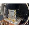
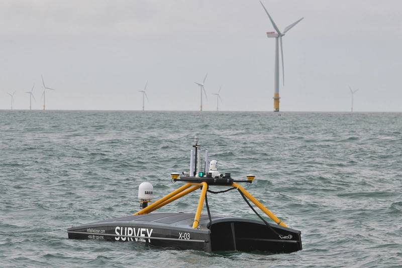 Photo courtesy XOcean
- You might have already answered this, but what attracted you to this position with this company at this time?
Well, I mentioned the focus on being able to efficiently map shallower waters faster and cheaper in order to be able to open up new applications. The other thing is I had spent a lot of time hiking, and we’re going to talk about that later, and thinking about what I wanted to do with the next phase of my career. I wanted to do something important that would have an impact on the earth. And there were really two crises that I had focused on. One of them is the climate crisis, and clearly, we need to spend a great deal of effort decarbonizing the maritime sector. And I thought that the platform that XOcean had already developed had the potential to revolutionize the way we do science at sea.
I’m a big fan of a lot of the uncrewed systems manufacturers and operators in the world, because those classes of vessels will be able to change the way we do science at sea; but we can’t do it at the cost of further carbon contributions to the atmosphere. I spent about 10 years at sea, and we used about 1,000 gallons of fuel a day, with an average of about a hundred days a year sea. It’s about four pounds of carbon per gallon, which comes out to 40 million pounds of carbon emitted from the ships I was on. [By comparison] it would take about 2000 years for XOcean’s entire fleet to emit that much.
- Well we cover the maritime, subsea and offshore energy industry closely, and it appears that all have transcended ‘being green’ beyond the marketing slogan only.
Both the maritime sector and the offshore energy sector are really taking this seriously. A lot of the companies that used to be oil and gas companies are now putting most of their effort into offshore wind and they’re watching the carbon content, not only of their own activities, but the results of their activities and those that are contracted to them to help them. So companies like XOcean, with tiny carbon footprints, are attractive to those folks. The maritime sector is 3% of the carbon load on the earth, and that’s not small potatoes.
- XOcean is certainly no stranger to this audience, but for those not in the know, can you give us a brief overview of the company and the technologies that it offers?
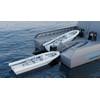
XOcean designs, builds and operates a fleet of uncrewed surface vessels for a variety of science and engineering applications at sea. We deliver the data. So we don’t sell our boats, we have only one customer for our boats and that’s ourselves. We then contract with somebody to do work, to provide the platform and the sensors to be able to allow them to collect their data. A lot of it has been seabed mapping, multibeam and sub bottom profiling, a little bit of fisheries work [among others].
One big benefit is there’s no personnel offshore, so we have no problem hiring as many super qualified people as we want right now. There are loads of people that have offshore experience that, for one reason or another, don’t find that going offshore again works with their lives anymore. We offer a huge lifestyle benefit.
So we’re able to recruit hydrographers, pilots and surveyors to work for us.
We talked about the low environmental impact, and not just the carbon, as we’re no discharge by design. We can operate for as long as we want inside no-discharge zones, which is a real problem for the research fleet, particularly in parts of the U.S.
To date we have about 40,000 operational hours and we’ve learned a lot in those 40,000 hours. All of those lessons learned have plowed back into our technology, back into our operations, and this isn’t a ‘new’ company anymore. We have a lot of operations, talent and experience baked into what we do.
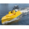
[Our vessels are) small and light, and as a result we have this logistical nimbleness. We can deploy from a normal boat ramp and refuel at a service station, an advantage as road fuel is cleaner than marine fuel. And our survey system is all cloud based; all processing is done in the cloud, and we don’t own a single server anywhere. So our surveyors can be working around the clock, we can put a lot of people on a project to get it done quickly and use all the benefits of cloud resource.
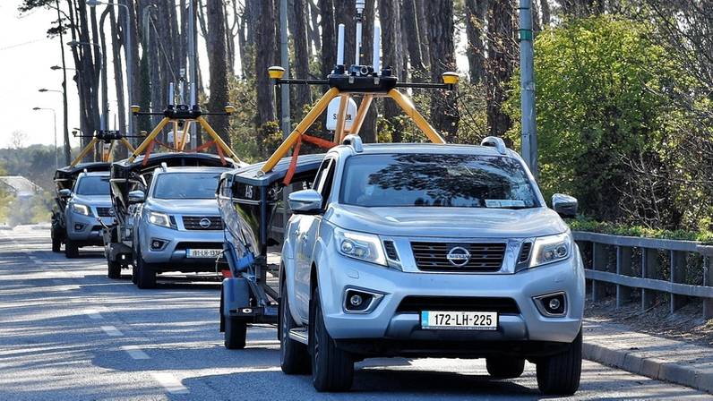 [Our vessels are) small and light, and as a result we have this logistical nimbleness. We can deploy from a normal boat ramp and refuel at a service station, an advantage as road fuel is cleaner than marine fuel. Photo courtesy XOcean
- The job is still relatively new to you but stepping into the job day one, can you discuss what your priorities would be for the coming 12 to 24 months?
We’re a fast-growing company, building a new boat a month right now and we expect demand to be increasing such that we’ll need to do that more or less indefinitely. The other parts of the expansion [include modifications and integration of different sensors and systems to ensure] we can meet most demands from our clients. And we’re looking at global expansion, too. Right now, we do most of our construction and maintenance in Greenore, Ireland, just north of Dublin. But when we start to have a significant [globally distributed] fleet, we want to be able to do [regular maintenance, upgrades and replacements] locally, so we’re putting together a quality control maintenance system that goes with a global fleet.
- You’ve had a long career and I’m sure along the way there have been many that have helped you. Can you discuss your most influential mentor?
I’m going to call out one guy, and it’s hard for me because he passed away last year. Rick Brennan was like a professional brother to me. He and I were more or less the same sort of seniority coming up all the way through NOAA and we had this way of clicking, a shorthand communication, knowing how the other was reacting to a situation without any real verbal clues. Rick had talents, particularly with people. I never have been the master with people that Rick was, and he could take a vision and inspire people with it.
He had set up some really visionary ways of integrating the ocean mapping program at NOAA, not only across NOAA so that the work we are doing for safety and navigation could also work for habitat and in fisheries, but also outside of NOAA so that we could do joint projects with the USGS and [others], to be able to learn from each other and do joint projects and really take this vision to reality of getting this done. Rick, himself, had so many mentees. I’m honored to claim that for myself as well.
- I understand that you recently took some time to hike the 2000-mile plus Appalachian Trail. Can you share insights on the experience, why you decided to make the trek, what you got out of it and what you learned about yourself along the way?
I left a week after I retired from NOAA and started in Harpers Ferry, West Virginia, which is about the halfway point and hiked north from there up to Mount Katahdin in Maine and then, flipped back down to Harpers Ferry and finished southbound. So I just followed Spring all the way up, and then flipped back down and followed the Fall all the way down into the south.
It’s sort of a whole lifestyle, homeless by choice, and you don’t have a lot of the amenities. My pack was pretty light, a 30-pound pack, but after climbing mountains with it, you really take a harder look at [your gear and ask] “Do I really need this? I haven’t used it in a week. I think I could probably get by without it.” So I kept dropping weight and simplifying.
I think that process was valuable, to really think about what’s important.
At NOAA I had a lot of people working for me, and I was a little bit of a public figure in my own little world. But once I got out of the trail, I didn’t have any of that. So it was fun to start over [and ask]: “Who am I in this world?”
So I am a recovering scientist, and I did a little project along the way, where I recorded a sound clip every hour at the top of the hour, a 15-second sound clip, which I then analyzed for the different frequency components and mapped it up in a GIS with the help of some great folks. And that was a really neat opportunity every hour, to just stop, listen and think. [Another great part is] there are people out there of all ages, really well integrated. The 60-year-olds were hanging out with the 22-year-olds, and it was just everybody doing this thing in a very supportive environment.
- Watch the full interview with Shepard Smith on Marine Technology TV: