MMT: Image Processing in Focus
(Photo: Rodrigo Pacheco-Ruiz)
Since the launch of its Surveyor ROV as primary tool of inspection and survey through the production of High-Resolution imagery, marine surveying firm MMT said it has taken another step forward.
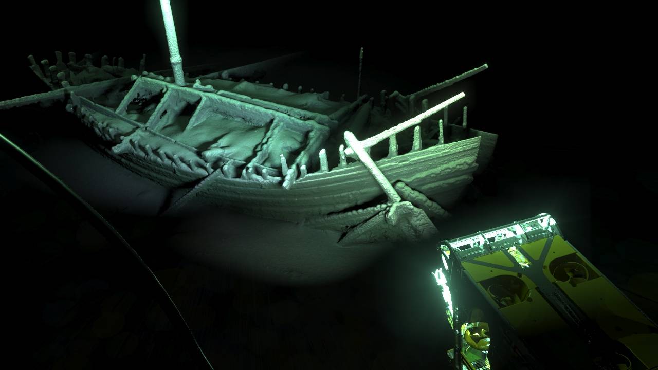
In a long-term collaboration, of more than a decade, between industry and academic research, MMT and Reach have conducted deep sea (up to 2,200 meters deep) high resolution photogrammetric surveys of more than sixty historically important shipwrecks in the Bulgarian Black Sea between 2016 and 2017.
The Black Sea Maritime Archaeology Project (Black Sea MAP), funded by the Julia and Hans Rausing Trust and led by the University of Southampton’s Centre for Maritime Archaeology, has uncovered new archaeological and scientific information spanning more than two millenia of human seafaring in the area. Amongst many of these shipwrecks was the 2,400 year old Ancient Greek merchant vessel, considered today the world’s oldest and deepest intact shipwreck ever to be discovered.
These photogrammetric models are the result of the combination of high resolution imagery to produce accurate 3D models of the shipwrecks integrated with multibeam and laser bathymetry to achieve optimum scaling and positioning results. MMT took on board University of Southampton’s visiting fellow Dr. Rodrigo Pacheco-Ruiz into their photogrammetry department who, together with his team, was in charge of the photogrammetric program of the Black Sea MAP.
MMThas also partnered with the KTH Royal Institute of Technology, currently developing interfaces of geophysical data and high resolution imaging integration with the aim to lead into a large-scale change in accuracy, resolution and processing speeds. This demonstrates MMT’s focus on image derived solutions for high resolution measurements and inspection and a new step towards the development of new technological advances with high quality and speed commercial outputs.