Makai & Triton Software Launch Advanced Ocean Vector Chart Service
Copyright_Makai Ocean Engineering
Makai Ocean Engineering will collaborate with Triton Software Ltd to integrate the innovative Ocean Vector Chart Service (OVCS) and provide access to high-resolution nautical charts directly in MakaiPlan, a submarine cable route planning software. This partnership introduces a powerful new feature to MakaiPlan by incorporating Triton Software’s API and hosted server for Lloyd’s Register’s worldwide vector dataset.
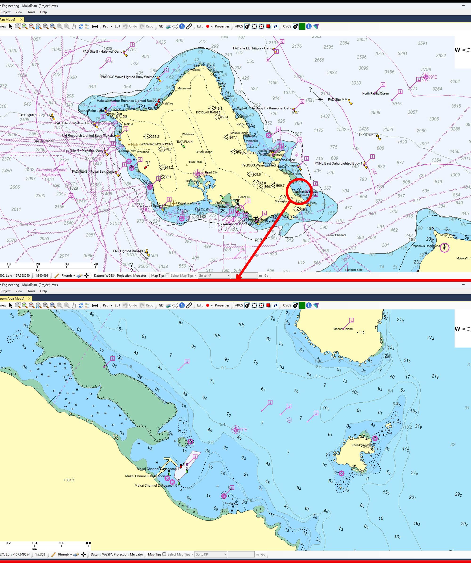
Compared to traditional Admiralty raster charts, the OVCS feature empowers users to access and display the web-hosted electronic navigational charts with enhanced resolution, detail, and precision. Moreover, users can interrogate individual objects within the charts to view their attributes, enabling greater accuracy and efficiency during the planning process. How OVCS Enhances Makai’s software suite, including MakaiPlan, already provides robust tools for analyzing bathymetry, avoiding obstacles, and optimizing cable routes. OVCS complements these capabilities by offering an advanced charting solution that improves data accessibility and clarity during planning. Key enhancements provided by OVCS include:
• Dynamic Charting Detail: Unlike static charts, OVCS dynamically adjusts the level of detail based on the zoom level, allowing planners to view both broad overviews and critical, location-specific information easily.
• Lloyd’s Register Vector Dataset: Access to Triton’s API and server for a worldwide vector dataset provides comprehensive global coverage, allowing cable planners to work confidently across various regions and scales. • Interactive Object Analysis: Users can interrogate chart objects like depth contours, buoys, and seabed features to view their attributes, improving situational awareness and decision-making.
• Simplified Workflow: OVCS eliminates the need for external charting tools by integrating all critical navigational data within MakaiPlan, reducing planning time and effort. Why OVCS Matters The installation of submarine cables is a technically demanding process, requiring precise planning to ensure cables are installed most safely and cost-effectively. While Makai’s software already handles detailed route optimization, obstacle avoidance, and raster nautical charts, OVCS adds value by improving how efficiently planners can automatically load and interact with the data. The enhanced charting capabilities of OVCS make it easier for planners to:
• Reduce risks associated with cable routing and installation. • Improve efficiency by centralizing essential data within MakaiPlan.
• Make more confident and informed decisions with real-time access to detailed marine information.