Saildrone: USVs Have Only Scratched the Surface of Maritime Security
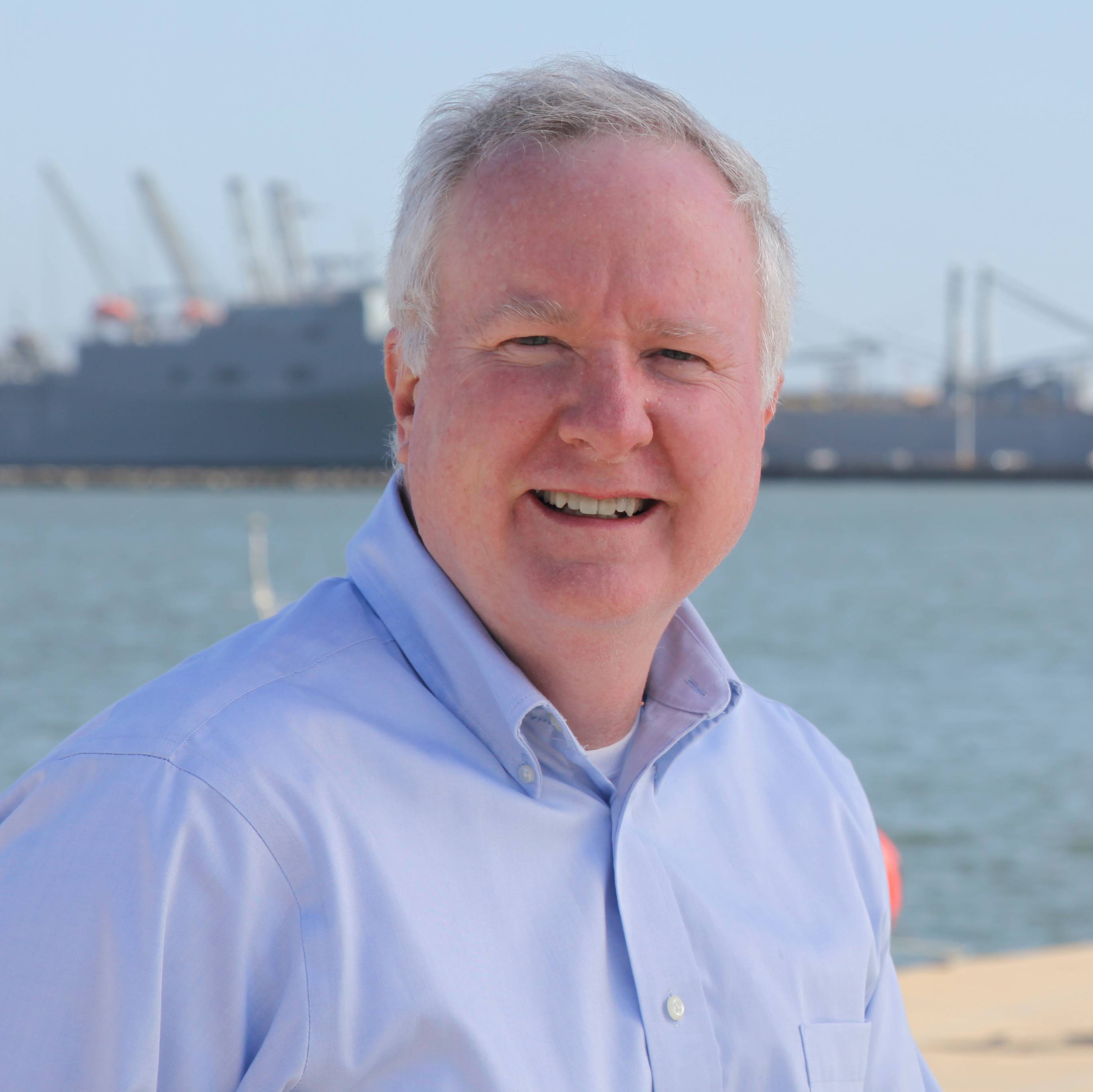
Brian Connon, Saildrone VP Ocean Mapping. Credit: Saildrone
Increasing global instability and emerging threats are reinforcing the mission criticality of maritime security and ocean intelligence. To meet that challenge, Saildrone, a company that builds and operates one of the world's largest fleets of unscrewed surface vehicles (USVs), is redefining how oceans are explored, monitored and protected.
At the helm is Brian Connon, vice president of ocean mapping and a former U.S. Navy oceanographer. After leaving the Navy, Connon joined a hydrographic research center at the University of Southern Mississippi, which lead to his role at Saildrone. Now, four and a half years in, Connon has helped establish and scale up the company's ocean mapping capabilities.
Saildrone sets the standard
In just over a decade, Saildrone has logged more than two million nautical miles and 50,000 days at sea, from the Arctic and to the Southern Ocean. "We circumnavigated Antarctica and we've served customers from NOAA and NASA to the U.S. Navy and U.S. Coast Guard, and in similar foreign civil and defense organizations around the world," noted Connon.
The company has delivered 100 Explorer-class, 45 Voyager-class, and 6 Surveyor-class vehicles—all manufactured in-house—designed to support a range of missions from research to reconnaissance.
Today, nearly 50 Saildrone vehicles are actively deployed, with almost full utilization focused on the high-capability Voyager and Surveyor platforms. "Our newer platforms have a lot more capability for the missions we're asked to do today," he says. And those missions are growing.
Three classes of vehicle
The Explorer, a 7-meter USV, is solely reliant on solar power and wind propulsion and provides ocean research data. "That was our starting point for Saildrone to get into the ocean-data market and work out the physical platform and the physics of sailing," explained Connon. "And then, we quickly realized that the potential at Saildrone exceeded the capabilities of the Explorer due to power or speed or size constraints. or all three."
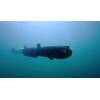
Next came Voyager, a 10-meter diesel-hybrid USV that serves as the primary platform for maritime security and shallow water mapping. It features a high-powered radar, automatic identification system (AIS) and a pan-tilt-zoom flare camera. It can also be equipped with shallow-water multi-beam sonar and a sub-bottom profiler. "That's what really gives us that large area coverage; we can conduct geophysical surveys, safety of navigation, offshore energy projects, and subsea infrastructure construction and monitoring," he said.
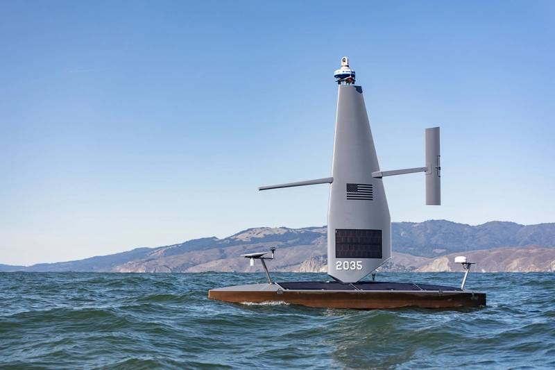 Voyager on the water. Credit: Saildrone
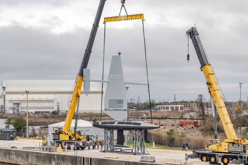
Last is the 20-meter Surveyor. In addition to the abilities of Voyager, it has deep-water survey capabilities equivalent to modern survey ships—covering missions like Exclusive Economic Zone (EEZ) mapping, subsea cable routes and offshore energy exploration.
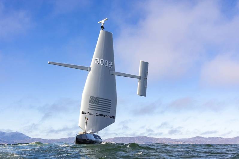 Surveyor on the water. Credit: Saildrone
Surveyor's recent mission with Meta to map deep-water portions of undersea cable routes has proven it can fill that role, despite being uncrewed. "What we showed was we can follow the route. We can collect the data to the standards that they need to determine if the route is safe to lay a cable. We showed that we can quickly alter that route if we do come across a sea melt or a canyon or some reason why we can't continue on the planned route," said Connon. Using USVs not only lowers costs but avoids 97% of the carbon of a standard survey ship. "This is a cost-effective and environmentally safe way to do an important job because the subsea cable market is really taking off.”
AI advances the mission
All of Saildrone's command and control software is developed in-house, with a focus on vertical integration that allows tight coupling of hardware, autonomy and mission management.
"Our platform has real-time fleet monitoring. We can do dynamic mission updates. We're doing secure data handling and built to allow us to scale globally. And since we own that full stack, we can rapidly adapt to new customer requirements," he said. "We can integrate emerging tech like machine learning and AI, while maintaining a tight control over cybersecurity. So, it's not about just building the drones, it's about managing oceans of data efficiently and securely."
In fact, AI is at the forefront of Saildrone's technology. "We've developed the largest image dataset of the ocean, and we used it to build a proprietary machine learning algorithm to detect and classify activity at sea. So, we're fusing multiple sensor streams into actual insights in near real-time," he explained. An object on the sea can be classified by the algorithm as a boat, or an iceberg, or a whale spout—to name a few. A recent partnership with Palantir Technologies is further driving optimism optimistic towards the role of AI.
Diverse Markets, Growing Demand
Ocean surveying serves as one of Saildrone's two leading markets. The race to understand the subsea world is intensifying as deadlines like Seabed 2030 loom. "We've only mapped 26% of the oceans to modern standards, but there's a general lack of capacity from traditional survey ships to accomplish this in a reasonable timeframe," Connon explained. More specifically, he noted, more small island states are trying to develop their blue economy. Whether they need to understand what's under the water within their EEZ, or they want to run undersea cables or establish offshore energy, the demand for ocean survey isn't waning.
However, maritime intelligence, surveillance and reconnaissance (ISR) may be experiencing an even bigger pull as customers realize the need for domain awareness. "We feel the maritime security sector will probably end up being the biggest portion of our business in the next three to five years," he predicted.
"We're seeing around the world more need to provide maritime surveillance to counter drug trafficking, illegal fishing and anything nefarious on the water where you need to have eyes," said Connon. Maritime security forces can't cover the entirety of the sea effectively. "So, what we do with Saildrone is we provide those additional eyes on the ocean more economically than having to procure or build new ships and then having to operate and maintain them."
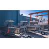
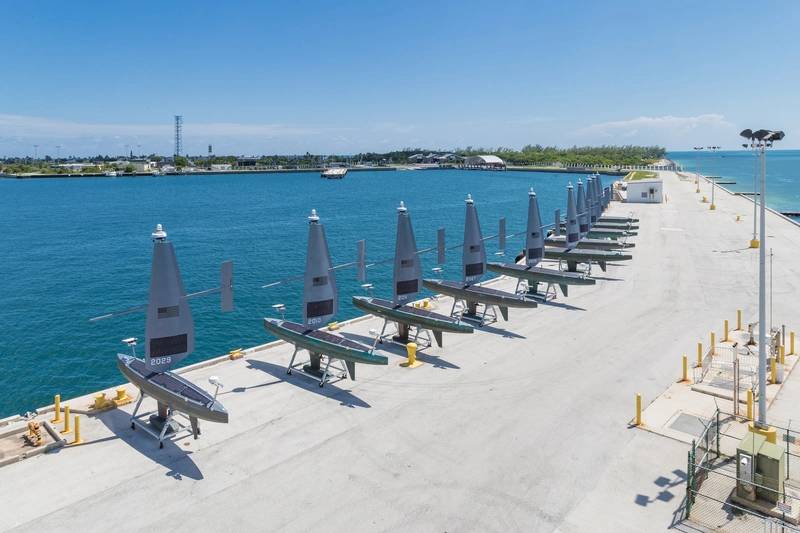 Voyager fleet. Credit: Saildrone
Additionally, Connon sees a trend towards specific types of USVs, as militaries are looking for vessels that can carry out niche missions. "Saildrone's a leader in that space. What we're hearing from the military is that a persistent presence and the ability to use radar, AIS, cameras and passive acoustics to look above and below the ocean is really what they're driving towards."
He looks forward to the industry’s future, adding that cost is another factor driving USV needs. "Shipbuilding is very expensive and is, in some ways, kind of broken in the sense that ships are over budget and way behind schedule. And so, they're going to be looking a lot more at autonomous solutions—not just the USVs, but AUVs and UASs as well, to help fill those gaps."
 Surveyor. Credit: Saildrone
Sailing into the future
As Connon and his colleagues look ahead, geographic expansion is on the horizon. This spring, the company announced Saildrone Denmark, a European entity based in Copenhagen. "This expansion reflects our commitment to supporting European allies and enhancing their maritime situational awareness through advanced autonomous technologies," he said.
As maritime challenges multiply—from climate to conflict—Saildrone is emerging as a trusted, tech-forward partner to governments, researchers and commercial operators. By building multifaceted platforms, investing in AI, and expanding its global footprint, the company is delivering on a vision of smarter, safer and more sustainable ocean operations.
And with the Explorer, Voyager and Surveyor fleets sailing further and faster than ever, it’s clear: the future of subsea intelligence isn’t just under the sea—it’s on the surface.
Watch the interview with Brian Connon on MTR TV.