Scientists Study Largest Underwater Volcanic Eruption


-
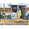
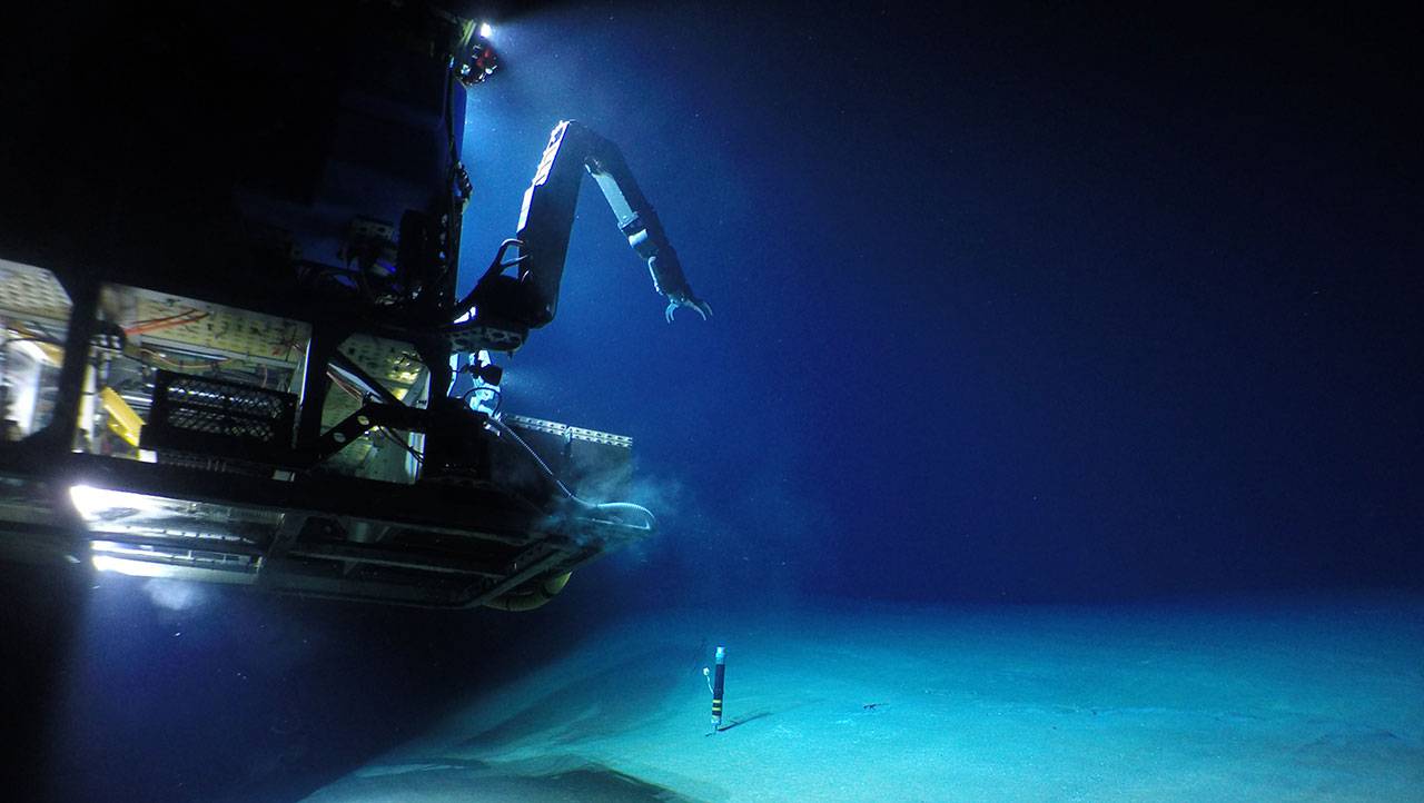
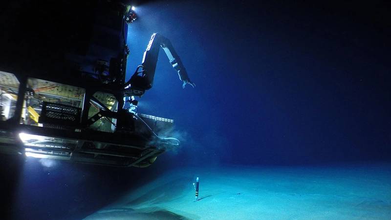 The remotely operated vehicle (ROV) Jason lands on the seafloor at Havre submarine volcano to retrieve a heat flow monitor. (Photo: Multidisciplinary Instrumentation in Support of Oceanography (MISO) Facility, ©Woods Hole Oceanographic Institution)
-
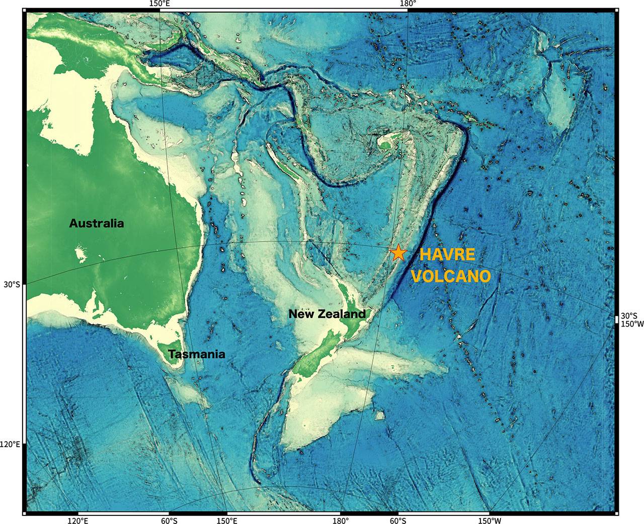
 The Havre volcano is located off the coast of New Zealand in the Kermadec Region, a volcanically active and tectonically complex plate boundary system. (Image courtesy of the Sentry Group, WHOI)
-
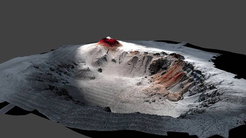 High-resolution seafloor topography of the Havre caldera mapped by the autonomous underwater vehicle (AUV) Sentry shows the new 2012 erupted lavas in red. The volcano is nearly a mile deep (1,519 meters). The top of the volcano is at 650 meters below sea level. (Image credit: Rebecca Carey, University of Tasmania, Adam Soule, WHOI, ©Woods Hole Oceanographic Institution)

In July 2012, airline passengers flying over the Southwest Pacific Ocean spotted a large and unusual object floating on the water’s surface.
That object, which turned out to be a giant raft of pumice, was evidence that an underwater volcanic eruption had occurred. And as the raft continued to grow to roughly the size of Philadelphia, scientists observed that the eruption was extraordinarily large.
The eruption had occurred at the Havre volcano northeast of New Zealand, and was the largest to take place underwater in the past century.
“We knew it was a large-scale eruption, approximately equivalent to the biggest eruption we've seen on land in the 20th century,” said Rebecca Carey, a volcanologist at University of Tasmania and co-chief scientist on the expedition to investigate the historic silicic eruption—a particular type of eruption that produces viscous, gas-filled lava, that often occurs explosively.
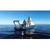
In 2015, the University of Tasmania led a mission to explore, map and collect erupted materials from the Havre volcano, together with scientists from Woods Hole Oceanographic Institution (WHOI), the University of California Berkeley, the University of Otago in New Zealand and others on board the research vessel Roger Revelle operated by the Scripps Institution of Oceanography.
Their paper published January 10, 2018 in the journal Science Advances describes the first up-close investigation of the historic volcanic eruption and reveals several surprises.
“Heading to the site, we were fully prepared to investigate a typical deep-sea explosive eruption,” said Adam Soule, WHOI associate scientist and chief scientist for the National Deep Submergence Facility.
“When we looked at the detailed maps from the AUV, we saw all these bumps on the seafloor and I thought the vehicle’s sonar was acting up,” Soule said. “It turned out that each bump was a giant block of pumice, some of them the size of a van. I had never seen anything like it on the seafloor.”
Havre is part of the Kermadec Arc, a chain of volcanoes, some of which reach the surface to form the Kermadec Islands, between New Zealand and American Samoa. The volcanoes are formed by conditions at the subduction zone where one of Earth’s largest tectonic plates, the Pacific Plate, dives beneath the Australian Plate.
Scientists from New Zealand had previously mapped the Havre volcano, a caldera nearly 4.5 kilometers across on the seafloor northeast of the country’s North Island, using shipboard sonar instruments in 2002, and again immediately after the eruption in 2012, revealing the presence of new volcanic material on the seafloor.
More than 70 percent of Earth’s volcanic activity occurs on the seafloor, but details of these events are largely hidden from view by seawater.
Despite their violence, little is known about silicic eruptions, in particular, and most knowledge about them comes from ancient rock records that lack details such as the timing, duration, source and water depth of the events. Prior to the Havre eruption, scientists have never been able to study a large underwater silicic eruption shortly after it occurred in order to better understand how they happen and what they produce.
Seeking new information on the events at Havre, the research team in 2015 deployed the autonomous underwater vehicle (AUV) Sentry in a series of 11 dives that mapped more than 19 square miles (50 square kilometers) of seafloor. The team also conducted 12 dives totaling 250 hours with the remotely operated vehicle (ROV) Jason to collect samples of erupted material and to capture high-resolution imagery of the seafloor inside the crater.
The scientists discovered that the Havre volcano’s eruption history was much more complicated than they previously thought, with the most recent eruption alone consisting of lava from 14 volcanic vent sites between 900 and 1,220 meters below the surface.
They also discovered that, what they thought was initially an explosive eruption that would produce mainly pumice, also created ash, lava domes and seafloor lava flows. Of the material that erupted, which was nearly 1.5 times larger than the 1980 eruption of Mount St. Helens, about 75 percent floated to the surface and drifted away with winds and currents, while the rest was spread across the seafloor up to several miles away.
“Ultimately we believe that none of the magma was erupted in the ways we assume an explosive eruption occurs on land,” Soule said.
Material collected using ROV Jason confirmed the diverse nature of the eruption, bringing samples of dense lava, ash, pumice and giant pumice to the surface, including one piece measuring 5 feet (1.5 meters) in diameter that is the first of its kind ever collected and is currently on display at the National Museum of Science and Nature in Tokyo.
The physical and chemical composition of these samples are now helping scientists learn how the eruption proceeded, what made it act the way it did, and how the material changes over time.