Shallow Water Monitoring Sensors Track GOM Nitrate Pulse


-
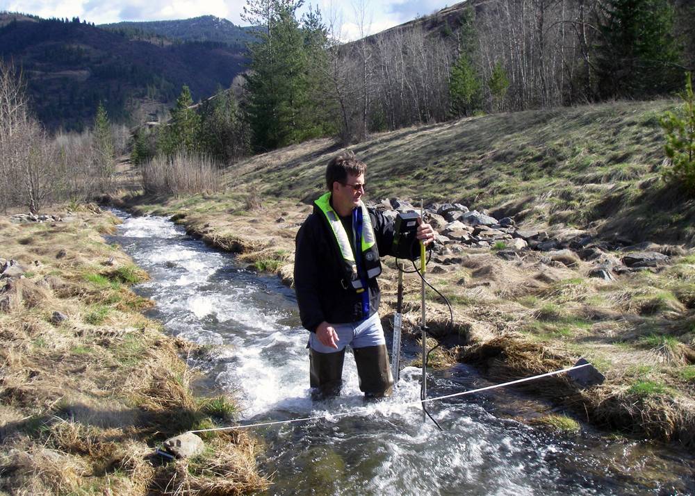
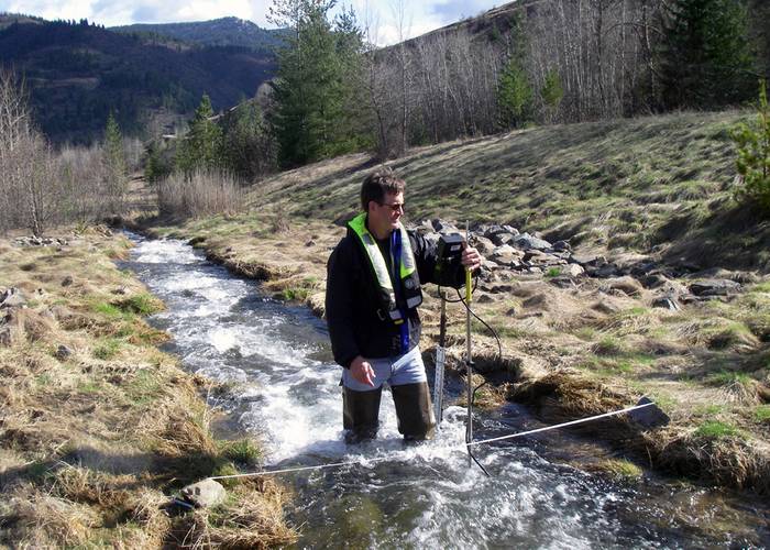 What: Hydrologist Measuring Streamflow When: 4/11/2014 Where: Smelterville, ID, USA Details: USGS hydrologist Greg Clark measures streamflow on Government Gulch Creek, a tributarty to the Coeur d’Alene River in northern Idaho. Streamflow data collected are included in the Coeur d’Alene Basin Environmental Monitoring Program the USGS conducts in cooperation with the Environmental Protection Agency. Credit: U.S. Geological Survey Department of the Interior/USGS U.S. Geological Survey/photo: De
-
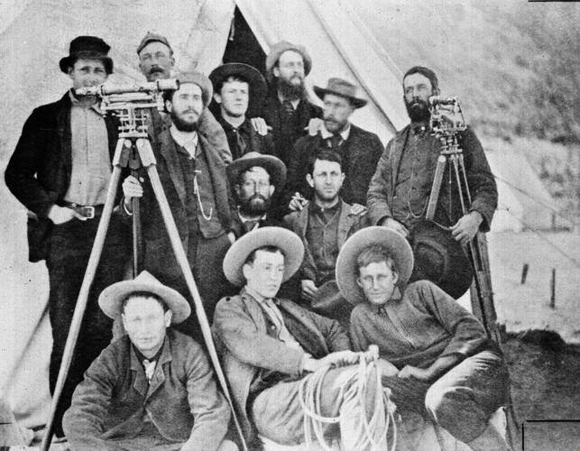 What: USGS Embudo Personnel When: 1888 Where: Embudo, NM, USA Details: Personnel of the USGS in the field of Embudo, New Mexico, the “birthplace of systematic streamgaging”, circa 1888. Personnel in photo: Back row: L.S. Kendall; W.P. Trowbridge, Jr.; Prof. E. Curtis; T.M. Bannon; F.H. Newell; G.T. Quinby; R. Robertson Middle Row: R.S. Tarr; R.P. Irving Front Row: R. Shumway (Packer); J.W. Mitchell; W.A. Farish Photographer Credit: USGS
-
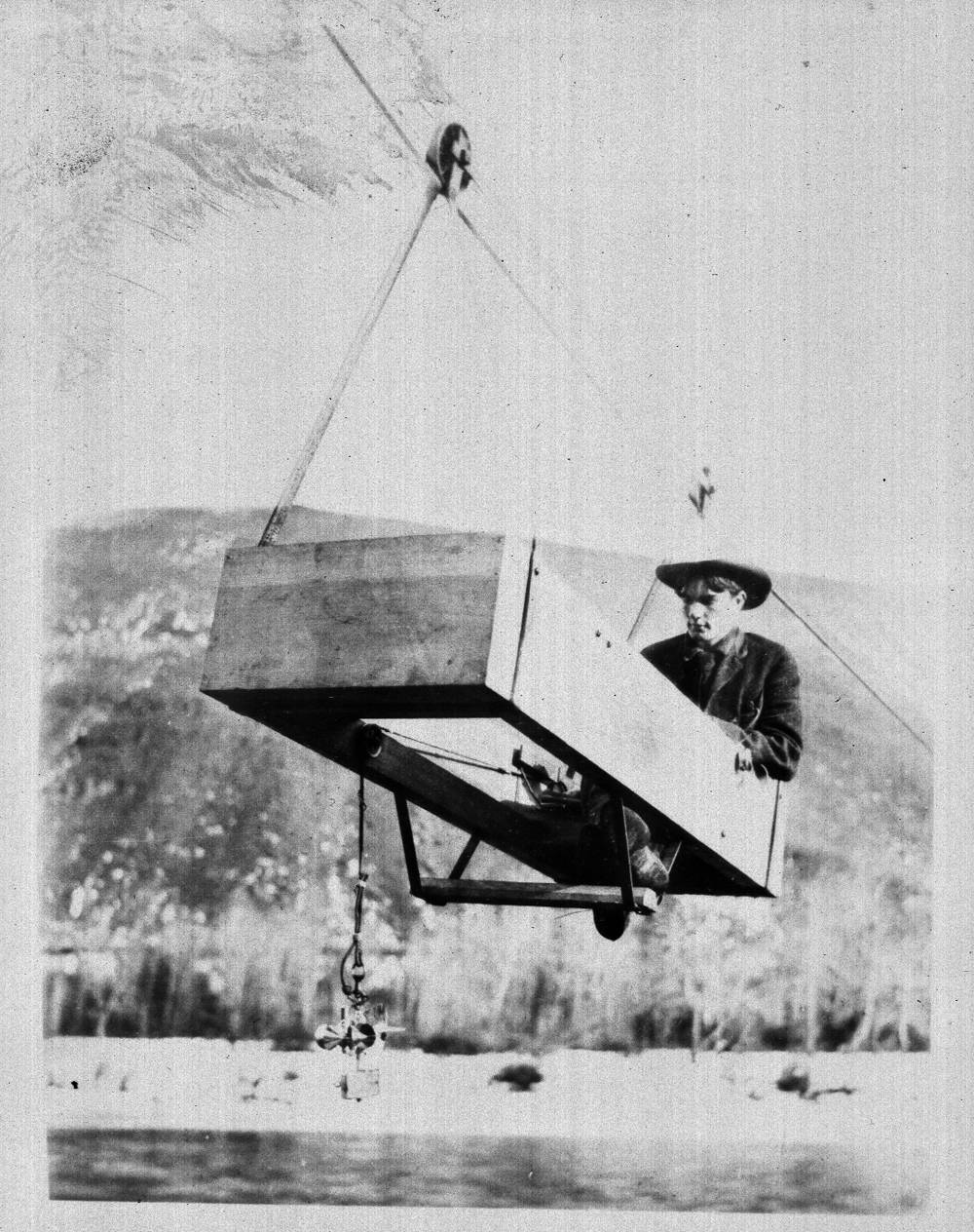
 What: Embudo Streamgaging When: 1888 Where: Embudo, NM, USA Details: Streamgaging at Embudo, New Mexico, circa 1888. Photographer Credit: USGS
-
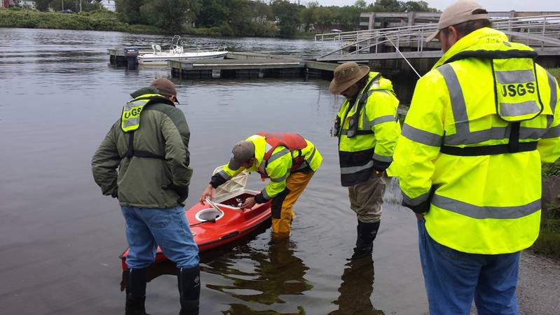 What: RC Boat When: 9/16/2014 Where: Gardiner, ME, USA Details: On September 16, 2014 the USGS Maine Office took a remote controlled boat to the Kennebec River in Gardiner to get experience operating the boat in “real world” conditions. This boat is used with an ADCP to measure streamflow or conduct bathymetric surveys. The RC boat is operated from shore, and can get into places that a regular manned boat can’t. Credit: U.S. Geological Survey Department of the Interior/USGS U.S. Geological Su


A new U.S. Geological Survey (USGS) report describes how advanced optical sensor technology is being used in the Mississippi River basin to accurately track the nitrate pulse to the Gulf of Mexico.
Excessive springtime nitrate runoff from agricultural land and other sources in the Mississippi drainage flows into the Mississippi River and downstream to the Gulf of Mexico. This excess nitrate contributes to the Gulf of Mexico hypoxic zone, an area with low oxygen known commonly as the “dead zone.” NOAA-supported researchers reported that the summer 2014 dead zone covered about 5,052 square miles, an area the size of Connecticut.
The USGS is using the new sensor technology to collect nitrate concentration data every hour to improve the accuracy of nitrate load estimates to the Gulf of Mexico. The data can also be used to make it easier to detect changes in nitrate levels related to basin management and to track progress toward the goal of reducing the size of the dead zone.
“High frequency data from these sensors has revealed considerable variability in nitrate concentrations in small rivers and streams,” said Brian Pellerin, USGS researcher. “However, we were surprised to see nitrate concentrations vary by as much as 20 percent in a week in a river as large as the Mississippi River without similar changes in streamflows.”
These rapid changes are very easy to miss with traditional water-quality monitoring approaches.
However, hourly information on nitrate levels improves the accuracy and reduces the uncertainty in estimating nitrate loads to the Gulf of Mexico, especially during drought and flood years.
This high frequency data also provides new insights into timing and magnitude of nitrate flushing from soils during wet and dry conditions.
For instance, the high frequency data revealed high nitrate concentrations during the spring and early summer of both 2013 and 2014 following the drought of 2012. Nitrate sensors on small streams and large rivers throughout the Mississippi River basin are improving our ability track where the pulses are coming from and forecast when they will arrive at the Gulf.
The USGS, in cooperation with numerous local, state, and other federal agencies, currently operates over 100 real-time nitrate sensors across the Nation.
Real-time nitrate monitoring is supported by the USGS National Stream Quality Accounting Network, Cooperative Water Program, and the National Water-Quality Assessment Program.
The following information was extracted directly from the U.S. Geological Survey (USGS) report. For full details and references, please visit:
http://ca.water.usgs.gov/pubs/2014/PellerinEtAl2014.pdf
Abstract
Accurately quantifying nitrate (NO3–) loading from the Mississippi River is important for predicting summer hypoxia in the Gulf of Mexico and targeting nutrient reduction within the basin. Loads have historically been modeled with regression-based techniques, but recent advances with high frequency NO3– sensors allowed us to evaluate model performance relative to measured loads in the lower Mississippi River. Patterns in NO3– concentrations and loads were observed at daily to annual time steps, with considerable variability in concentration-discharge relationships over the two year study. Differences were particularly accentuated during the 2012 drought and 2013 flood, which resulted in anomalously high NO3– concentrations consistent with a large flush of stored NO3– from soil. The comparison between measured loads and modeled loads (LOADEST, Composite Method, WRTDS) showed underestimates of only 3.5% across the entire study period, but much larger differences at shorter time steps. Absolute differences in loads were typically greatest in the spring and early summer critical to Gulf hypoxia formation, with the largest differences (underestimates) for all models during the flood period of 2013. In additional to improving the accuracy and precision of monthly loads, high frequency NO3– measurements offer additional benefits not available with regression-based or other load estimation techniques.
For the Full Report with References
Brian A. Pellerin, Brian A. Bergamaschi, Robert J. Gilliom, Charles G. Crawford, JohnFranco Saraceno, C. Paul Frederick, Bryan D. Downing, and Jennifer C. Murphy, 2014, Mississippi River Nitrate Loads from High Frequency Sensor Measurements and Regression-Based Load Estimation, Environmental Science & Technology 2014 48 (21), 12612-12619,
http://ca.water.usgs.gov/pubs/2014/PellerinEtAl2014.pdf
(As published in the November/December 2014 edition of Marine Technology Reporter - http://www.marinetechnologynews.com/Magazine)