Subsea Case Study: Acoustic Remote Sensing for Underwater Archaeology


-
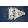
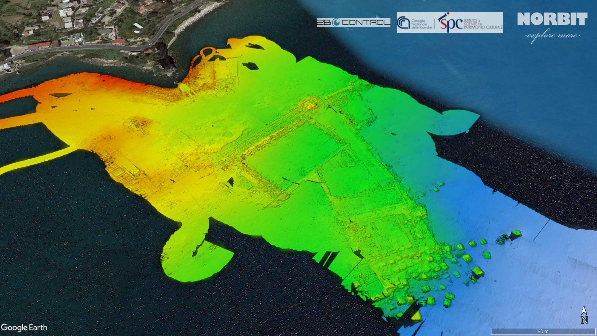
 Fig.1. General view of mapped bathymetry in the Baia Marine Protected Area. Image courtesy Norbit
-
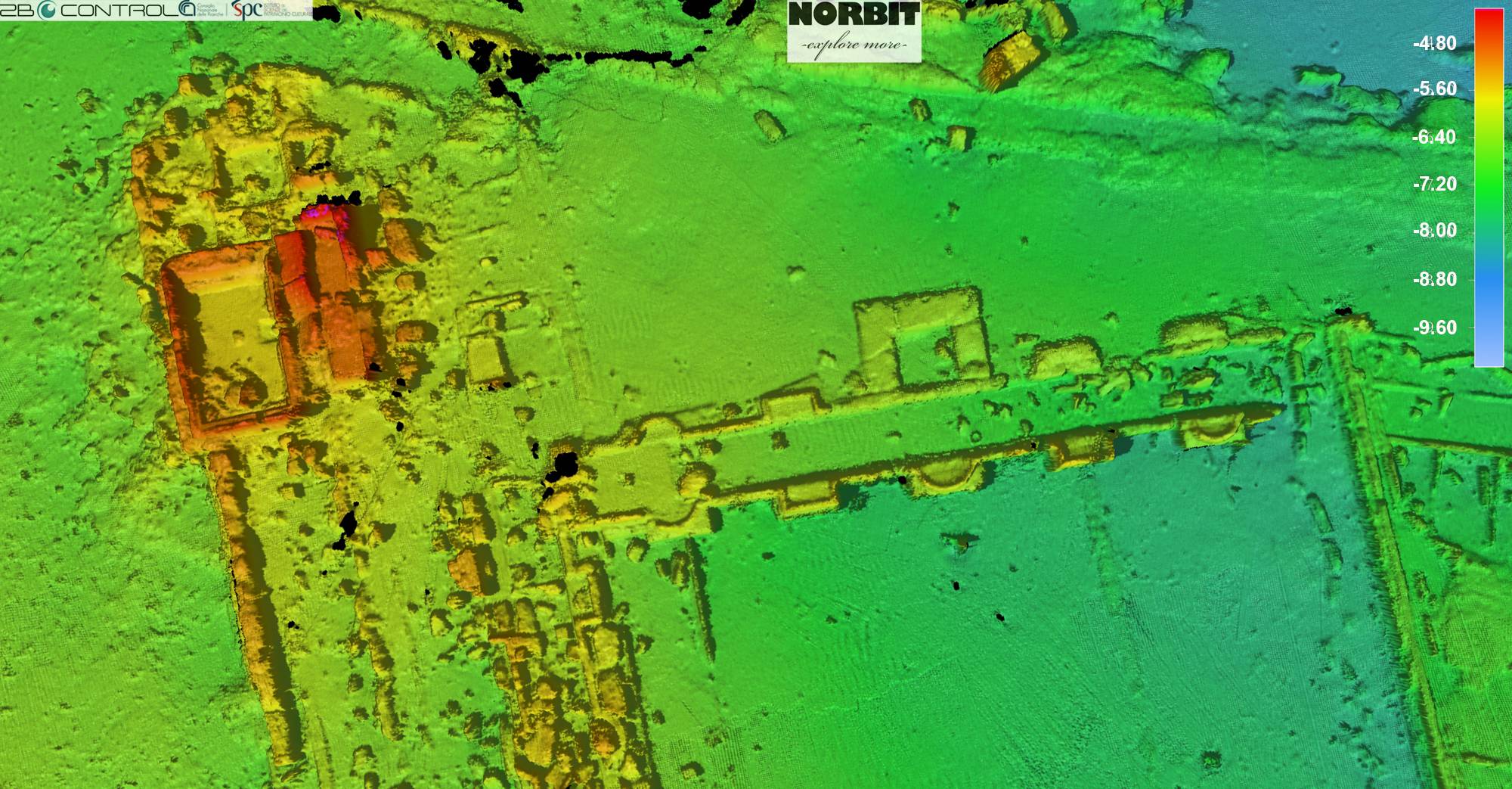
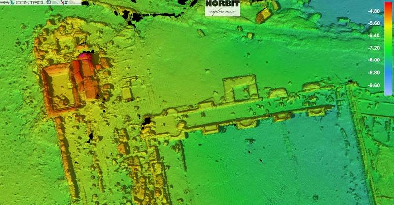 Fig.2. Submerged site of the Pisoni’s villa and surroundings. Image courtesy Norbit
The greatest archaeological treasures are not only hidden below the ground but many of them remain below water, on the seabed and beneath.
This is the case of the submerged city of Baia located in the Gulf of Pozzuoli in the western part of the Bay of Naples (Italy). It was a famous and fashionable resort city in Roman times, with luxury villas and baths with hot springs. Mostly of the city was submerged between the 3rd and 8th century AD due to vertical ground movements induced by a local volcanic phenomena known as “Bradydeism”.
To protect this, in 2002 the underwater site of Baia was designated as Marine Archaeological Park and Marine Protected Area with an incomparable cultural and natural value. There are several underwater archaeological assets ranging from 5 to 13m of depth. One of them is Villa dei Pisoni (fig. 1), which was owned by very wealthy Roman patricians but was later sized by imperial authority following a failed conspiracy against Nero.
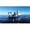
In November 2021, Norbit Subsea and 2BControl, in collaboration with Institute of Heritage Science of the Italian National Research Council (ISPC_CNR, Naples) have conducted a very successful demonstration in the Baia submerged Park. Recent developments in high frequency acoustic mapping allow for detailed reconstruction of submerged objects providing a valuable tool for recognizing and describing archaeological resources at the seabed (figs 2 and 3). Surface imaging with centimetric resolution using multibeam sonar gives a wide and comprehensive picture of underwater sites of cultural interest.
The survey carried out on 8 m long motorboat r/v ULISSE during 2 days of data acquisition, using the WINGHEAD i77h, the new high-resolution multibeam sonar system from NORBIT.
A 10 cm DTM is the first result of the high data density and resolution acquired, a primary record of the current state of the submerged archaeological features. The extreme details and accuracy obtained will help to refine the overall mapping and measurements of the villas, supporting the Park monitoring and preservation. Moreover, thanks to the ultra-high resolution of the xyz real data detected (centimetric resolution) the 3D shape point clouds views are an adding and meaningful value for the interpretation of the secondary features mapped inside the villas, great support to the deep understanding of the ancient use of the areas present in this spectacular submerged site.
The WINGHEAD is a part of NORBIT curved array, bathymetric integrated systems family with 1024 true beams (0.5°x0.9°), frequency range of 200kHz to 700kHz and high-end navigation. Its portable and light construction allows fast mobilization on almost every boat. Friendly user interface with easy-to-follow setup steps makes it very easy and quick to learn. Most of the parameters can be left as default and provide precise bathymetry even for an unexperienced operator.
Even though archaeological research in the Baia area started in XIX century, the Gulf of Pozzuoli still has many secrets to reveal. Remote sensing methods based on underwater acoustics have a big advantage over diver’s work. As they can provide a full picture of extensive areas with high resolution images helping to understand their current state and past function. With these innovative tools new discoveries are within reach.
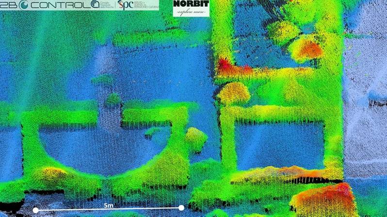 Fig.3. Zoomed point cloud view of the north-west side of the Pisoni's villa based on multibeam data. Image courtesy Norbit
About the Authors:
- Crescenzo Violante PhD is Senior Technologist at the Institute of Heritage Science (ISPC) of the National Research Council (CNR) in Naples (Italy).
- Paola Fabretti, Account Manager Product - 2B CONTROL SRL, NORBIT representative & dealer Italy
- Dr. Aleksandra Kruss, benthic habitat mapping specialist, surveyor and scientific expert of NORBIT Subsea