Marine Technology News Search
Search term • "advanced navigation"
Create an email alert for "advanced navigation"
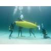
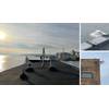
Human Powered Submarine Races Underway
The second European International Submarine Races are now underway at QinetiQ’s Ocean Basin at Haslar, Gosport – Europe’s largest covered water freshwater space. Nearly 100 students from 10 universities around the world are jockeying for position in this unique engineering and sporting event, which sees pilots in SCUBA gear pedalling furiously in their totally submerged submarine around the huge tank, which is the size of an international soccer pitch.
AWS Wave Power Generator Deployed
AWS Ocean Energy developing its wave power technology for use in fish farms, harbor breakwaters through to major utility-scale offshore wave farms. Inverness-based AWS Ocean Energy has taken a step forward with the successful deployment and initial testing of a half-scale AWS-III wave power generator. The test program took place at Lyness in Orkney, Scotland, and will help the company develop its energy…

Awards Ceremony Recognizes NRL Researchers
Eighteen U.S. Naval Research Laboratory (NRL) scientists and engineers representing ten NRL research divisions were recognized with the prestigious Dr. Delores M. Etter Top Scientist and Engineer of the Year Award. The award ceremony was held on June 6th, with Assistant Secretary of the Navy (Research, Development & Acquisition) Sean Stackley, and Dr. Delores Etter presenting the awards. This annual award is sponsored by the Assistant Secretary of the Navy for Research…
Case Study: Floating top marks for piles in flooding rivers
Grupo Lindley was approached by Administração dos Portos do Douro, Leixões e Viana do Castelo in Portugal to improve the reliability of the aids to navigation in the Douro River. Along this stretch of navigable waters there are many piles that when the river floods become totally submerged.In conjunction with Instituto Hidrográfico (Portuguese Navy), Almarin together with sister company Lindley in…
How to Prevent Mass Extinction in the Ocean Using AI, Robots and 3D Printers
The ocean is the most defining physical feature of Earth, covering 71% of the surface of this planet. It is home to incredible biodiversity, ranging from microscopic bacteria and viruses to the largest animal on Earth, the blue whale.We still do not know how many species live in the ocean, but the disappearance of an increasing number of them suggests that extinction is taking place, perhaps at a faster…
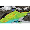
Miros Sensors put to the test in the Port of Gdynia
Miros has installed a tailored environmental monitoring system to support a three-year research project at the port of Gdynia in Poland. The custom system is designed to provide accurate current and wave measurements and oil spill monitoring from a strategic location in the bay of Gdansk. The expected results will be used to create recommendations for the operation of unmanned units in ports and will be made available to governmental organisations.

MTS Names Ostrander Executive Director
The Marine Technology Society announced that Chris Ostrander was selected as the organization’s new executive director, effective March 8, 2022. An oceanographer and business development executive, Chris has more than 15 years of experience in building and leading complex organizations, advancing mission-driven partnerships, and guiding durable growth for a range of academic, government, and private organizations.

Contact Rationalizing and Map Corrections Software
Chesapeake Technology Inc. (CTI), a producer of real-time sonar acquisition and GIS based processing software for seafloor mapping, announced two new capabilities that it claims will allow users to better organize sonar contacts and improve sonar mosaic accuracy. New Contact Rationalizing, available on SonarWiz version 05.06.0052, is designed to allow a user to combine contacts into a single merged target with an average position.
Saab Seaeye eRobotics Campaign Wins UTC Award
A project that achieved a world first in subsea vehicle deepwater residency capability, proving the potential for marine autonomous systems to take a greater role in underwater inspection, repair and maintenance methodologies, is the winner of the annual UTC Subsea Award.The UTC Subsea Award, presented by the Underwater Technology Foundation (UTF), is designed to recognize the many outstanding achievements within the subsea industry.

iXblue Expanding in Australia
Navigation, positioning and imaging firm iXblue said it is expanding its local capabilities in Australia. In 2019, it will focus on developing the company’s local expertise in Inertial Navigation Systems for both defense and civil markets.“We have been present in Australia for over 10 years with a dedicated Brisbane-based team of highly qualified engineers, hydrographers, geophysicists, program managers and equipment sales staff,” said Fabien Napolitano, CEO of iXblue.
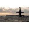
SSBN Force Level Requirements: It’s Simply a Matter of Geography
There have been recent claims that today’s ballistic missile submarine force is operating with excess capacity and, therefore, force reductions to save resources may be in order. As I have noted in response to a recent op-ed, this supposition is untrue – in fact, our lean SSBN force is providing the cornerstone of our national security at a pace that has remained essentially constant since the late 1990s.
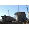
Research Vessels Construction Progressing as Scheduled
Seattle-based Naval Architecture and Marine Engineering company Guido Perla & Associates, Inc. (GPA) reports that construction of the AGOR 27 R/V Neil Armstrong is progressing according to plan at Dakota Creek Industries (DCI) in Anacortes, Wash. A major milestone was achieved recently with the completion of the hull assembly after the stern block was set, followed by the installation of the pilot house.
Deep-sea Canyons and Seeps Discovered Off U.S. Northeast
Ocean explorers in July on NOAA Ship Okeanos Explorer discovered a wide diversity of seafloor features and communities of life in the largely unexplored deep-sea canyons off the northeast U.S. coast. Now through August 16, as the expedition continues, the public can join the mission as "citizen scientists," at oceanexplorer.noaa.gov/okeanos, to see live seafloor video and listen as scientists discuss their observations in real time.
China Offshore Fugro Geosolutions to Sign New Contract
When the recently signed 10-year extension comes into effect on 23 August 2013, Fugro will enter the fourth decade of the successful joint venture with China Oilfield Services Ltd (COSL). Services provided include precise navigation services, subsea positioning, construction support services and remotely operated vehicle (ROV) services. The joint venture, named China Offshore Fugro Geosolutions (COFG) in which Fugro holds 50%, has been operating successfully offshore China since 1983.
Quay Contract Awarded at Lerwick Port
Plans for significant further expansion of Lerwick Harbour’s extensive deep-water facilities for the offshore oil and gas industry have advanced with the award of a major contract to extend the quay at Dales Voe South to support subsea developments and decommissioning. Lerwick Port Authority has commissioned the Scottish business unit of civil engineering contractor BAM Nuttall as main contractor for an £11.95 million investment to lengthen the quay to 130 metres.
Kongsberg's Acoustic Scientific Research for RSS Sir David Attenborough
Kongsberg Maritime has been awarded a contract by Cammell Laird as the primary supplier of the acoustic scientific research and mapping equipment for the British Antarctic Survey’s new Polar Research Vessel, the RRS Sir David Attenborough. The new polar research ship, owned by Natural Environment Research Council (NERC), is currently under construction at the Cammell Laird shipyard in Birkenhead in the Port of Liverpool City Region, UK in a build project worth £140million ($178mln).

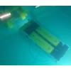
New Scanning Sonar for Tetis ROVs
EofE Ultrasonics, Korea, reports it has delivered 10 sets of scanning sonar Echologger MRS900 to Tetis Group. The 2,000m rated ultra-compact scanning sonar will be installed on Tetis' ROVs. Commenting in the delivery, EofE ultrasonics said, "We are delighted that Tetis decided to have Echologger scanning sonar for their ROVs after intensive testings and comparisons. It demonstrates that performance…
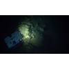
Exploring Alien Oceans with AUVs
Shielded by a thick, brittle ice surface, a vast warm ocean hides beneath. Scientists consider Jupiter’s smallest moon, Europa, to be the most promising for alien life and have set in motion multiple concept ventures to design an autonomous underwater vehicle (AUV) which could successfully explore this remote, off-world environment. Many Europa-bound missions are yet to come to fruition and prove the feasibility of this ambitious and complex task, until now.
TE Subcom Supplies MAREA Submarine Cable System
Facebook, Microsoft, and TE SubCom, a TE Connectivity Ltd. company and an industry pioneer in undersea communications technology, has announced that TE SubCom has been named the system supply partner for the new MAREA submarine cable across the Atlantic Ocean. TE SubCom has completed the route survey and begun manufacture of the system at its facility in Newington, New Hampshire. The parties are on track to begin laying cable using TE SubCom’s state-of-the-art cable installation ships next year…
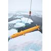
AUVs Under Ice: Past Milestones, Promising Future
The marine environments beneath ice are arguably some of the least accessible on earth. Ice is a formidable physical barrier that can range in thickness from centimeters to hundreds of meters—an impediment that has not diminished our desire to uncover the secrets that lie beneath. In the heyday of manned submarines, under-ice was seen as an important operating theater, where the ability to listen and monitor one’s foes was crucial.