Surveying Shallow Water from Space: EOMAP Launches SDB-Online


-
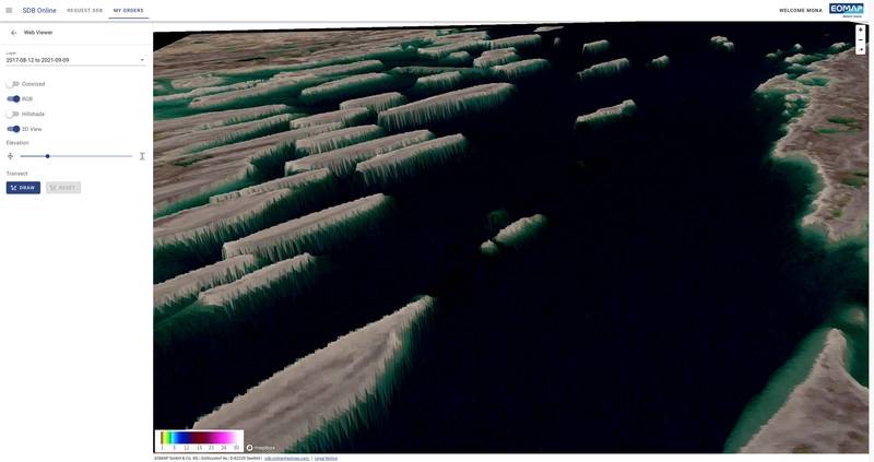
 Screen1: 3D visualization by SDB-Online of coastal area in northern Canada - © EOMAP
-
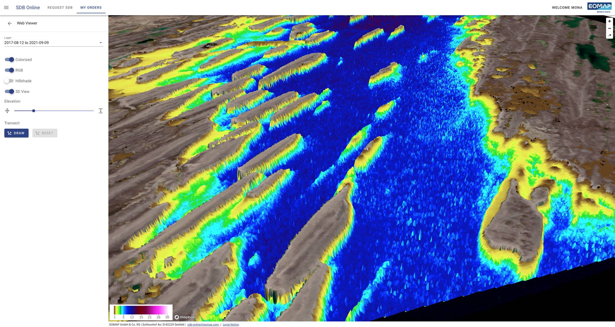
 Screen2a: 3D visualization of an SDB-Online bathymetry grid overlaid by an RGB satellite image and transect profile a coastal area in Canada by the SDB-Online Web Viewer - © EOMAP
SDB-Online is the new cloud-based WebApp to create high-resolution bathymetric grids for shallow waters. With SDB-Online, coastal engineers, surveyors, modellers or scientists can create high-resolution bathymetry grids 24/7, from the comfort of their desks.
“EOMAP’s SDB-Online is delivering fast and accurate results without the need of ground control data, processing 10 scenes in less than one hour. The “Combine” option (multi-image processing) is a game changer in challenging locations, especially with frequent cloud cover or heavy vessel traffic”, says Véronique Jégat, Senior Geo-Data Engineer at Fugro.
In addition, bathymetric power users can integrate SDB-Online via API into their own software solutions, like QPS does: “During our prototyping, I was impressed how quickly things came together for the two development teams. Particularly elegant was how EOMAP combined multiple images of the same area to give the best possible depth estimate. The workflow is already very smooth, and now we‘re keen to work with early adopters to advance these tools“, reports Jonathan Beaudoin, Managing Director, QPS B.V.
 .“Experts managing or studying coastal shallow waters will experience an incredible time and information gain: Within minutes they can trigger automated processing routines and receive high-res bathymetry data for their projects,“ Mona Reithmeier, SDB-Online Manager, EO Data Analyst, EOMAP. © EOMAP
Underwater topography – bathymetry – is crucial for many different coastal stakeholders: On the basis of bathymetric data, coastal engineers calculate and plan their projects, surveyors decide where to set up on-site campaigns, modellers analyse and predict coastal dynamics, while scientists study seabed morphology and benthos. So far, they often had to either perform work and cost intensive on-site surveys or to rely on insufficient data from other sources. SDB-Online helps: It enables the above users to access high resolution bathymetric grids of shallow waters without on-site surveys – rapidly and easily.“Experts managing or studying coastal shallow waters will experience an incredible time and information gain: Within minutes they can trigger automated processing routines and receive high-res bathymetry data for their projects“, says Mona Reithmeier, SDB-Online manager and SDB expert at EOMAP.
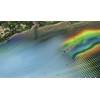
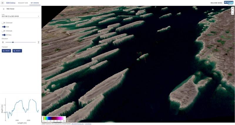
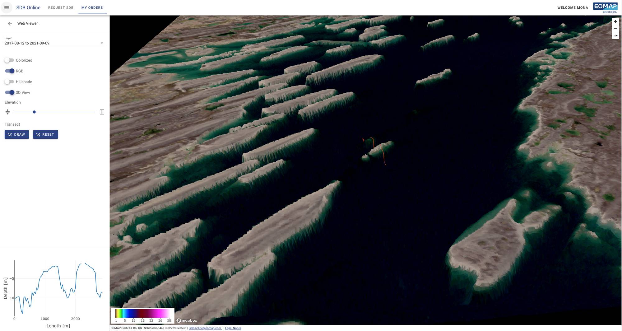
 Screen2: 3D visualization of a bathymetry surface overlaid by an RGB satellite image of coastal area in northern Canada by SDB-Online Web Viewer - © EOMAP