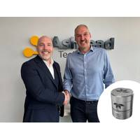
Ashtead Technology Orders Teledyne’s New Autonomous Navigation System
Teledyne Marine has secured its first orders for the Compact Navigator, the company’s new ultra-compact autonomous navigation system for subsea and surface vehicles.Ashtead Technology has placed a significant initial order, marking the first commercial adoption of what is said to be the world’s smallest and highest-performing, fully integrated autonomous navigation solution.The Compact Navigator is Teledyne Marine’s latest advancement in navigation technology, designed to deliver high-precision positioning and enhanced performance in a lightweight, ultra small form factor. The
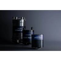
Ocean Business: Teledyne Marine Introduces New Technologies and Solutions
Business 2025 is the launch venue for a lineup of new technologies and industry solutions from Teledyne Marine. Visitors to Stand T7 and Dockside HS 02 can experience firsthand the latest advancements in marine navigation, acoustics, and sensing technology, including the exclusive launch of the Compact Navigator.Compact Navigator – the world’s smallest and highest performing, fully integrated autonomous navigation solution is revealed at Ocean BusinessSeaBat T51-S – the enhanced SeaBat T51 now reaches 6000m depth while ensuring reliable, hands-free operationWorkhorse Proteus
Sonardyne Introduces New Hybrid Acoustic-Inertial Navigator
Sonardyne International Ltd announced the launch of SPRINT-Nav U, the world's smallest hybrid acoustic-inertial navigator designed specifically for compact marine robotic platforms.This technology delivers the proven performance of Sonardyne's SPRINT-Nav family in a package measuring 135 mm tall by 114 mm in diameter and weighing only 600 grams in water.SPRINT-Nav U represents an advancement for operators of small ROVs, AUVs, towfish, and USVs, who can now access survey-grade navigation capabilities previously available only to larger platforms. The system combines four critical instruments&mdas
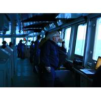
Ice Navigation: Every Voyage is Different
It’s late in the season so Captain Duke Snider, sailing on a resupply voyage from New Zealand to Antarctica, is expecting virtually no sea, just glacial ice.Snider has been an ice navigator for decades, and he has seen the ocean change, not just here in the polar south, but in Arctic waters as well.“Variability is much greater than in the past when we could expect an ice breakup to occur within a calendar week, year after year, whether it was the Arctic or the Antarctic,” he says. “Now, you have to look at each year individually and be more alert than ever before, particularly
Motus Technology to Deliver Cranes for NOAA’s Research Vessels
our dedication to providing comprehensive, trustworthy, and reliable deck handling equipment,” said Magnus Lerheim, VP Sales in Motus.In 2023, NOAA announced it would be adding two new charting and mapping vessels to the NOAA fleet.The two Class B research ships will be named Surveyor and Navigator.The Surveyor and Navigator will be built by Thoma-Sea Marine Constructors in Houma, Louisiana, and are expected to be completed in 2027 and 2028

NOAA Reveals Names of its New Mapping Vessels
The National Oceanic and Atmospheric Administration (NOAA) has revealed the names of two new charting and mapping vessels it ordered from Thoma-Sea Marine Constructors in 2023.The names Surveyor and Navigator were chosen from a list of suggestions by NOAA staff, adhering to the agency’s naming policy that emphasizes vessels named for their missions.The name Surveyor holds significant historical weight. It not only pays homage to NOAA's mission but also honors two previous vessels that bore the same name. The first Surveyor, launched in 1917, was the first oil-burning steamer in the Coast and
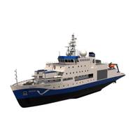
Canada Launches Offshore Oceanographic Science Vessel
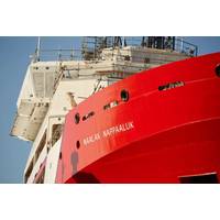
information. The vessel can also support search and rescue operations and environmental response, when needed.Naalak Nappaaluk was a respected Inuk Elder from Kangiqsujuaq, Nunavik, a village of 800 along Quebec’s northernmost tip. Nappaaluk was a renowned leader, harvester, teacher, consultant, navigator, astronomer and meteorologist. As a knowledge keeper, he was committed to protecting and promoting Inuit language and culture and did so his entire life by teaching others how to survive and thrive in his Arctic homeland.The CCGS Naalak Nappaaluk is a key deliverable for the Canadian Coast Guard
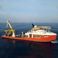
Solstad’s Normand Navigator Boards ROVs Ahead of New Job
Solstad Offshore’s Normand Navigator subsea vessel has arrived to Norway for the mobilization of remotely operated vehicles (ROVs) ahead of its new assignment.The mobilization of ROV’s from Omega Subsea Robotics is currently ongoing at Husøy (Karmøy) in Norway.The mobilization follows the completion of factory acceptance tests (FATs) a week earlier by Solstad’s supplier Kystdesign, with Omega Subsea and Solstad Services.After the mobilization, set for completion by the end of June 2024, Normand Navigator’s new project, which include survey services in addition to
OET Testing New ROV Cameras for 3D Model Making
array system and Norbit wideband multibeam sonar. The widefield camera array was co-developed by the Ocean Exploration Trust and Sexton Corporation with funding from the Office of Naval Research (ONR). A customized software package for the Norbit sonar was recently developed by Corps of Exploration Navigator Dr. Kristopher Krasnosky, which takes raw data collected by sonar and allows onboard teams to visualize it in real-time.High-resolution visual and acoustic data collected by the ROV-mounted sensors will be used to develop high-fidelity georeferenced models of surveyed landscapes. While similar


