Marine Technology News Search
Search term • "advanced navigation"
Create an email alert for "advanced navigation"
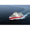
MHI to Build for PGS
Mitsubishi Heavy Industries, Ltd. (MHI) received an order for two vessels capable of three-dimensional (3D) seismic data acquisition for sea bottom resource exploration from Petroleum Geo-Services ASA (PGS). The order for the two vessels, which was signed on April 25 in Tokyo, was placed upon exercise by PGS of the option right that was provided when two same type vessels were ordered to MHI in April 2011.
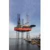
Keppel Delivers Arabian Drilling Company Rig
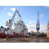
Keppel delivers its 45th KFELS B Class jackup rig with another 18 such rigs on order. These KFELS B Class rigs make up more than 30% of the total jackups completed globally since 2000. The rig was delivered to Arabian Drilling Company (ADC) 14 days ahead of schedule, on budget and with a perfect safety record. Keppel FELS earning them an early delivery bonus of US$210,000. Named ArabDrill 50 at a ceremony, the rig will be chartered to Saudi Aramco for operations in offshore Saudi Arabia.
Diginonymous, GW Partner for Offshore Medical Software
Software developer Diginonymous LLC and Maritime Medical Access Program at The George Washington University (GW) Medical Faculty Associates have teamed up to offer an advanced shipboard video telemedicine service for the international maritime industry to help clients meet the International Labor Organization’s (ILO) Maritime Labor Convention (MLC) 2006 requirements for crew healthcare. The GW Maritime Medical Access Program and Diginonymous developed the Digi+Doc service…
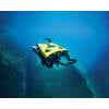
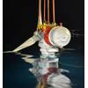
Ashtead Technology Orders Teledyne’s New Autonomous Navigation System
Teledyne Marine has secured its first orders for the Compact Navigator, the company’s new ultra-compact autonomous navigation system for subsea and surface vehicles.Ashtead Technology has placed a significant initial order, marking the first commercial adoption of what is said to be the world’s smallest and highest-performing, fully integrated autonomous navigation solution.The Compact Navigator is Teledyne Marine’s latest advancement in navigation technology…

Naturally Quiet
The Arctic’s bowhead whales can live for over 200 years. Imagine what they might hear in that time: screw propellers were only just being used to power ships 200 years ago, and diesel engines appeared some hundred years after that.The underwater radiated noise of shipping has grown globally, but the Arctic is a special place. It has been partially shielded from shipping noise. Sea ice shields and diffuses underwater sound…
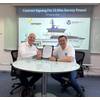
Fincantieri Invests in Deep Tech Scale-Up for Naval and Submarine Sector
Fincantieri has formalized its investment in WSense, a deep tech scale-up specialized in underwater monitoring and communication.The transaction involves the subscription of a convertible loan for an initial amount of $2.84 million, with the option to increase the investment by a further $2.84 million.The timescales for the conversion into equity will be contingent upon the occurrence of specific conditions…

Britlift Spreader Proves Value on Royal Research Ship
A modular spreader beam from Britlift is proving a success on the Royal Research Ship (RRS) Sir David Attenborough, one of the most advanced polar research vessels in the world.Operated by the British Antarctic Survey (BAS), this multidisciplinary research platform operates year-round, spending the northern summer in Arctic. During the southern hemisphere summer it is based in Antarctica where its duties include bringing people, equipment and supplies to BAS research stations.
VideoRay, BlueHalo Awarded $30.7M Navy Contract
VideoRay, a BlueHalo company, was awarded a $30,735,784 contract to provide systems engineering and support services for the company's Mission Specialist Defender systems, the Maritime Expeditionary Standoff Response (MESR) remotely operated vehicle (ROV). The five-year contract was issued by the Naval Information Warfare Center (NIWC) Pacific and supports the U.S. Navy’s ongoing operations utilizing the Mission Specialist Defender systems.The award follows the U.S.
Research Vessels: A Conversation with Bruce Applegate of UNOLS
The U.S. oceanographic research community depends on a complex network of ships and institutions for scientific discovery at sea. The University-National Oceanographic Laboratory System (UNOLS) is the central organization that provides scientists with access to advanced research ships and technology to explore the world's oceans. We recently spoke with Bruce Applegate, Chair of the UNOLS Council and Associate Director at Scripps Institution of Oceanography…
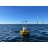
Fugro, Spoor Join Forces for AI Bird Monitoring for Offshore Wind Farms
Fugro and Spoor, a software company that helps renewable energy projects reduce their environmental impact, have signed a memorandum of understanding (MOU) to develop a new bird-monitoring solution for offshore renewable energy projects.The artificial intelligence (AI)-powered system will not only help protect bird populations but also supports the growth of renewable energy by making environmental assessments more affordable…
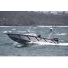
Autonomy: L3 ASV, Dstl Complete Demos
L3 ASV announced the completion of a series of demonstrations at the Australian Defense Showcase, Autonomous Warrior 18.In support of the Defense Science and Technology Laboratory (Dstl), L3 ASV operated a 9-m vessel outfitted with autonomous navigation capability for reconnaissance, interdiction and patrol tasks.The vessel, dubbed MAST-9, operated in fully autonomous mode, including COLREG aware collision avoidance…

The Power of Scientific Collaboration is Perennial
This week at Marine Technology News...American physicist John Bardeen, the only person to be awarded the Nobel Prize in Physics twice, once said: “Science is a collaborative effort. The combined results of several people working together is often much more effective than could be that of an individual scientist working alone.”That power proved itself again this week.Scientists from the University of…
Japan’s First Megawatt-Scale Tidal Energy Turbine Hits Water
Proteus Marine Renewables has deployed the AR1100 tidal turbine in Japan, which became the country's first ever megawatt-scale grid connected tidal energy system.Installed in the Naru Strait, the turbine will generate 1.1 MW of clean energy, accelerating the decarbonization of the Goto Islands' electricity supply and advancing Japan’s renewable energy transition.Building on the success of the AR500 pilot project in 2021…
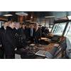
VOS Sweet Named at Oranjewerf Shiprepair Amsterdam
Vroon Offshore Services (VOS) new Subsea Support Vessel was named at Oranjewerf Shiprepair Amsterdam, part of Damen Shipyards Group, on February 8th, 2013. The vessel called at Oranjewerf early January after a voyage from China to The Netherlands to undergo a series of modifications at the shipyard. The new vessel is named after a Rolling Stones song. Among the various modifications Oranjewerf executed are the installation of a 24 tonnes crane and a fully equipped workplace in the aft.

Underwater Surveillance Milestone: Novacavi’s Hybrid Cable Passes Successful Test
Novacavi recently supported the successful deep mine shaft test of Image Soft’s UNWAS – a special underwater surveillance system - with one of its special fiber optic cables. With its hybrid water-blocked configuration, this underwater cable solution acted as a strategic component of the specialized system designed to detect and warn of any potential actions against sensitive critical infrastructure such as pipelines, subsea cables, ports, and harbors.
Russian PSV Icebreaker Named, Yards to Build More
President Vladimir Putin names icebreaking platform supply vessel 'Vitus Bering' & Russian shipbuilders sign newbuild contracts. Modern multipurpose vessels of the Vitus Bering series will conduct year-round deliveries of personnel, goods and expendable supplies to oil production platforms. In particular, it is planned to use this type of icebreaker to ensure the smooth operation of Sakhalin-1 oil platforms in the Arkutun-Dagi field in the Sea of Okhotsk.
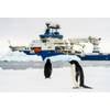
Schmidt Ocean Institute Successfully Concludes Inaugural Antarctic Expedition
After a year of preparing the ship and crew, Schmidt Ocean Institute’s research vessel Falkor (too) has completed its first science expedition to Antarctica. The three-week expedition, which ended in early January, was ambitious in its science scope and required operational refinements to navigate safely in unfamiliar environmental conditions.“Operating our ship in the Southern Ocean marks a significant milestone in Schmidt Ocean Institute’s history…
Keppel’s Logs $8.1B in Contracts in ‘12
Keppel Offshore & Marine Ltd's (Keppel O&M) subsidiaries have won three new contracts - worth a combined value of $343mn - to bring the group's total order wins for 2012 to $8.1B. Mr Tong Chong Heong, CEO of Keppel O&M, said, "With the strong confidence and support of new and repeat customers, Keppel O&M continues to be the provider of choice for a broad range of offshore and marine projects. "2013…
Strategic Marine to Build Survey Vessel for Odyssey Group
Singaporean shipbuilder Strategic Marine has signed a shipbuilding contract with Odyssey Group for a multi-purpose survey vessel, which will operated offshore Australia.Under the terms of the agreement, Strategic Marine will construct the advanced survey vessel tailored to meet Odyssey Group’s specific operational needs.The vessel will be equipped with the latest technology, including gyro-stabilization for improved vessel stability and operational capability…
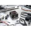
Movella Launches new Xsens Inertial Sensor
Movella launched its new ‘flagship’ inertial sensor, the high-end industrial grade “Xsens Sirius” Series: the next generation of sensors succeeding the Xsens MTi 100-Series. Featuring Inertial Measurement Unit (IMU), Vertical Reference Unit (VRU) and Attitude and Heading Reference System (AHRS) capabilities, Xsens Sirius is engineered to deliver reliable unmatched 3D, real-time and accurate data in the most demanding conditions.


